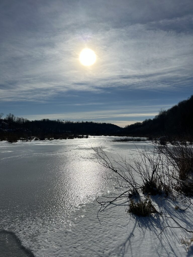
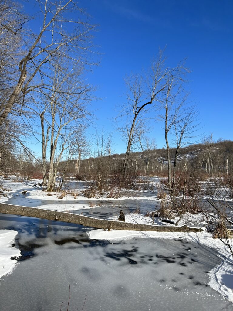
December is moving right along and I was lucky enough to get out for my first ice walk last week down on Beaver Creek. It’s not fully frozen however and called for some finicky maneuvers. I picked my way close to shore for a time but eventually ventured out onto a section of the main channel for some photo opportunities. There was a little bit of snow on top of the thin ice in the shallower areas but the main channel had a thicker and slightly safer layer of “snow ice”. Not the nice clear ice of hard freezing nights before a snowfall but the aftermath of snow that froze as it covered the water’s surface. Always tricky! But the savvy Icewalker knows the benefits of speedy traveling on bare ice rather then struggling through the rugged woods on shore. Dry feet aren’t the constant companion of an Icewalker. Neither is a dry body for that matter. The trick is staying on top! As always the Icewalker’s motto must be remembered: “The distance in must be traveled out.” Its much more pleasant to travel out dry!
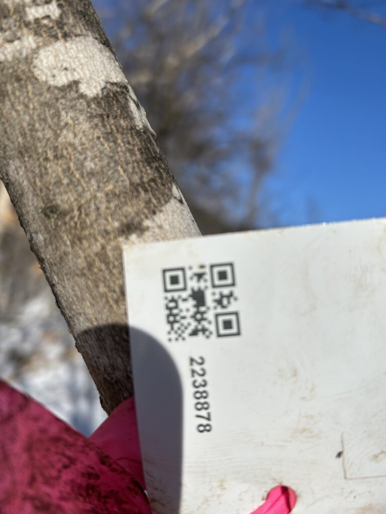
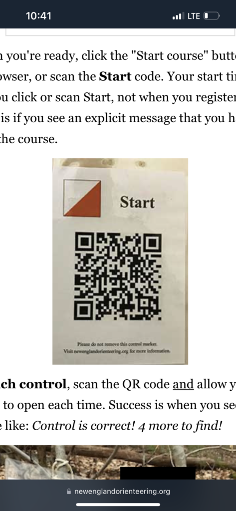
I assessed the wetland system via my sister’s property just down over the hill from our main farm buildings. The ridges along both sides of the wetland are rather steep and difficult hiking. Rocks and fallen trees make for slow going. Thus the allure of the ice. I hadn’t quite reached the ice when I spotted a pink ribbon tied to a tree. Strange given this is private property. A closer look revealed that there was a tag attached to the small tree. It had a scan code and seven numbers on it. I used my IPhone to attempt to “ open” the code but nothing worked. I considered taking the tag with me but decided I shouldn’t without consulting with my sister first. I continued to hike on.
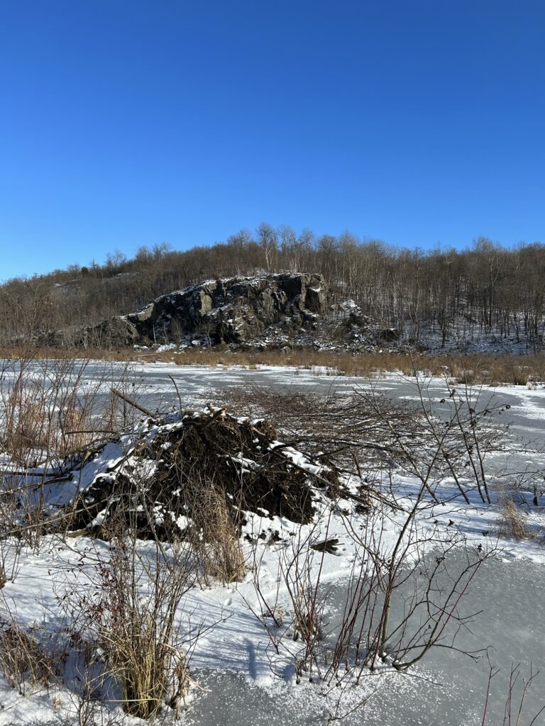
There’s always something to see when hiking the Beaver Creek gorge I’ve learned over the years. The beaver continually alter the wetlands by building dams along its course. Given the width of the wetland it’s a major engineering endeavor for the beaver to accomplish. But they’ve been at it for years and grassy foundations of former dam activity have made an almost solid foundation in one spot. There’s a choke point where the channel narrows through a shallow section of the swamp. A small dam here floods a large area and doesn’t challenge the beaver all that much. There’s usually beaver activity here but this year they had raised the dam some and subsequently there was a lot more wetland covered with deeper water.The muskrats had build numerous houses in this larger section. The most I had seen in years. Once I reached the dam I was in a bit of a situation! The ice below it was brittle and caving in. “Shell ice” we call it. The result of water depth dropping with no time for adequate freezing. It’s the Icewalker’s nemesis!
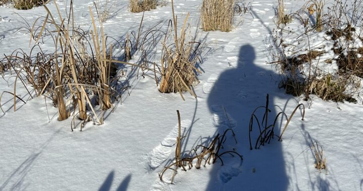
I bog hopped my way towards the distant shore from my location in the center of the swamp. It was a challenging series of carefully executed moves. Perhaps like a soldier picking his way through a minefield in a movie. I was losing my nerve by the minute and regretted my decision of early ice walking.It was beautiful in the soft maple forest that survives there though. In the midst of trees and small clumps of tag alders I was saved from the wind. The sun was shining down on me as I slowly crept closer to the solid land that was tantalizingly close. It was a cold afternoon and I really wanted to stay dry! I reached the narrow channel and edged out onto the thin ice. Gracie the dog was close behind and seemed a little nervous herself! Suddenly a series of cracks appeared under my feet. I froze and several more shot out in different directions. It once again reminded me of a movie scene! But in the movies the hero never falls through! There was no time to waste so I ambled forward in a sliding shuffle that covered the distance quickly. I reached the shore soon after and celebrated my good fortune! I was off the ice and had no interest in going back out after that. I decided to head for the high ground.
I began to ascend the steep ridge that reaches all the way down to the shoreline. I got on a deer trail that crosses the slope of the ridge in the easiest path. Trust the animals to find the best way upward. I hadn’t gone far when I spotted another one of the pink ribbon/scan code tag combinations. It was identical to the first one and covered with muddy fingerprints despite being exposed to the elements. Had someone dug in the dirt before handling it? I once again trying scanning the card to no avail. I pressed on towards the high ground.
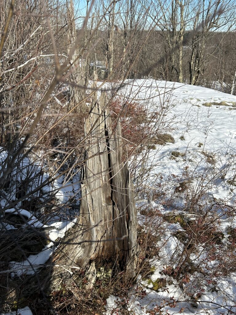
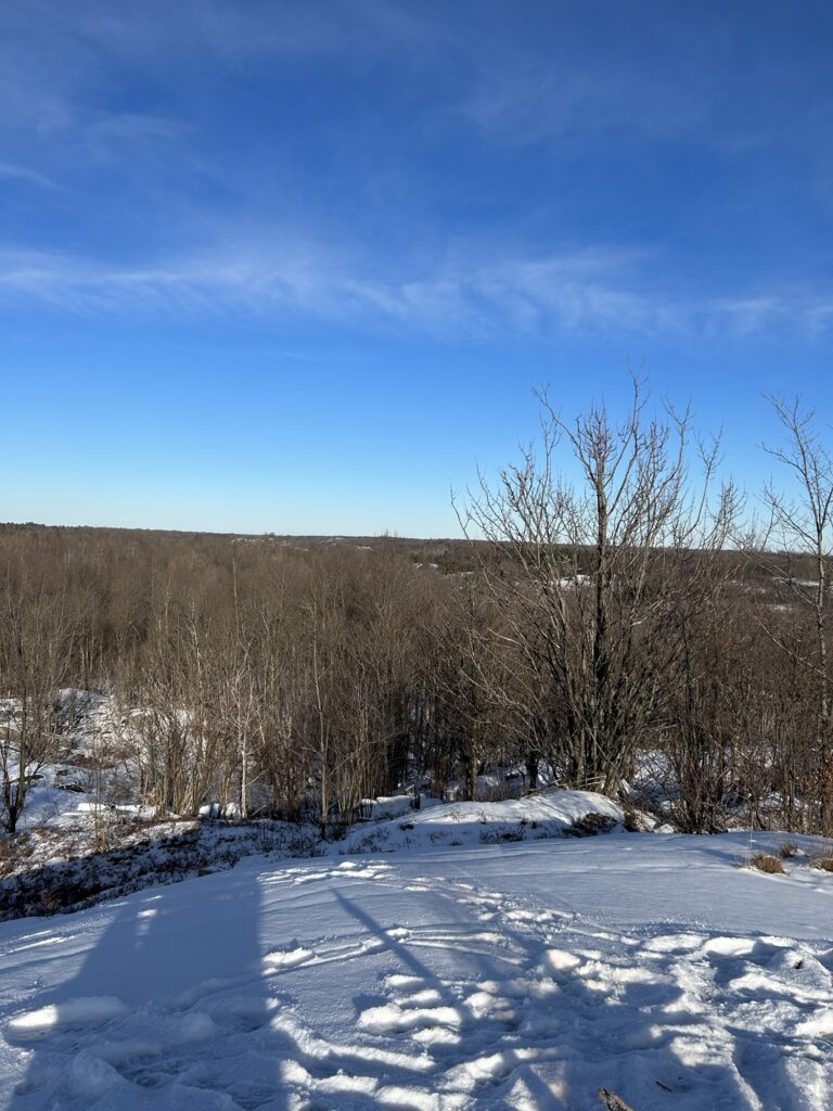
I was headed to a large rock bluff that we named the “Mid Point” when we were teenagers. It sits between two other rocky bluffs called the “Low Point” and the “ High Point”. I suppose we could have been more imaginative but it’s a rather accurate description overall. The LP and the MP are somewhat close together while the HP stands higher about one half mile away to the East. The views are spectacular in a 360 degree panoramic fashion. They are some of the highest places around in the area. A favorite boyhood haunt of mine. We camped years ago on all of them at one point or another. There’s a reason why the rock is bare upon them and the evidence still remains many years later. A forest fire destroyed the white pine groves that once occupied them during a dry spell. Deliberately set I was told although I have no factual proof to confirm this. The fire was so hot it literally burned the topsoil right down to the bare rock in the higher sections. Even to this day you can find the charred pitchy root balls and stumps that are super rot resistant in their rocky perches. We discovered as teenagers they made excellent firewood and burned with a brightly lit fragrance.No need for artificial light when one was used and the wood burned for a long time. Just when the fire occurred is an unknown to me.Over a hundred years I suspect given my age. I hope to research that sometime if archives exist.
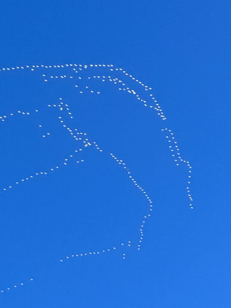
I found a place to sit on the Mid Point and snapped a few photos. It was a bit chilly with a North born breeze hitting me but I was warmly dressed for a December day. I kindled a small fire to keep the chill at bay and sat for a long time. It was a place very familiar to me and one that I try to reach every December before Xmas. It is my place for silent reflection and I always have it to myself. Gracie plopped down next to my legs and she made an excellent windbreak! Off in the distance my silence was interrupted at times by three pairs of jets doing some type of military exercises. Most of the time they were silent leaving streaming contrails like writing in the sky. They left eventually and the sky was silent until a flock of snow geese passed overhead.
I added wood to the fire several times. I burned a small piece of pine stump and was rewarded with the familiar scent of pine resin. ( pitch trapped in the roots). I noticed another pink ribbon down in the woods below but didn’t bother to check it out. I assumed it was the same as the others. It was getting late so I finished off the fire and began the trek back towards the farm.
Since then I have attempted to figure out the mystery of the ribbons and scan code tags. The tags are actually called QR codes. (Quick Response).

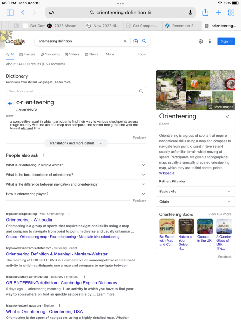
I have put requests up on social media pages asking for help. People had lots of comments and have been super curious as to the origins of the tags. I finally got a break through yesterday when a friend of mine who works at a local land trust suggested that the tags may belong to an orienteering group. Not a subject that I knew much about although I had heard of it. I began to research online and was soon rewarded with some promising information. I now believe that the mystery tags are from an orienteering group but remain baffled by the lack of information printed on them. I probably should explain orienteering first. I think the photo below pretty much sums it up however.

I also contacted the New York State DEC in regards to the ribbons and tags. They had no knowledge of orienteering groups that had been holding events in the state land near the farm. Apparently the group pulls a permit in advance. The DEC quickly became interested in what I had discovered and will be actively looking for answers. I thank everyone at the DEC for getting me connected with the proper individuals! I pledged my assistance in helping them locate the ribbon locations. One officer walked me through placing “drop pins” using Goggle Maps. I chose the satellite map option and easily dropped the pins close enough to the the locations they should find them given the absence of leaves. I was familiar with geocaching so was used to working from satellite maps. Once Zane and I discovered a huge wetland area on a satellite map that we didn’t know existed. We have yet to launch a probing expedition into the area given its gnarly rugged location. Yes I said expedition! It will be a winter snowshoe into unknown territory and must be treated as such with proper preparation. But that’s a different story for a different day.
When I head out for a trek I just never know what I will find! It seems technology is never too far away at anytime. I have no wish to bring anyone under scrutiny for their hobby but orienteering ribbons and tags should be removed after events close out according to the DEC. Also by the basic rules of leave no trace ethnics. But having a campfire in a former campsite location puts me in a similar predicament to be totally honest. Not illegal but certainly leaves a trace. I suppose it’s a fine line to walk and I could easily not even mention the fire. But I felt it pertinent to be honest and forthcoming as I have always promised.
For the moment the mystery has not been solved despite the research. The tags could be totally belong to some other group. Perhaps military or some environmental study group as some suggested. In fact there may be a conspiracy involved. Facts are facts despite what people choose to believe. Remember our furry rodent friend from Quebec Mr. Jangles? He’s been strangely silent for some time now. He still holds a grudge I suspect. I sent him a Xmas card and a block of cheddar cheese but haven’t heard back from him. Tracking indicates that the package was delivered by float plane ahead of the ice up. I believe he has begun a retaliatory mission despite my best efforts to strike up a truce. As of late we have been under attack by rodents at the farm in an unprecedented manner. The bucket traps have been busy and the tractors have been spared damage for the moment. There have been 15 necessary rodent causalities recently unfortunately. They brought the fight to us and we fought back. We granted them sanctuary elsewhere on the farm property but apparently they have refused the offer. Perhaps this sounds as crazy as ever but the facts remain. There is a lake in Western Quebec named Dumoine. There is a cabin 5. There is a mouse named Mr. Jangles with whom we fought an epic series of battles in August this year. There have been 15 rodents eliminated recently at the farm in record time. As for the rest? Form your own opinions. People were asking about Mr. Jangles so I needed to mention him. We are unsure of his present state and we wish him Happy Holidays! I expect we will hear from him again. Until then Happy Holidays to everyone! ✍️