It’s very close to the end of February now and winter is finally showing signs of releasing some of its icy embrace. But not quite yet. The amount of snow we have reminds me of this time last year when I was wading through deep snow building tubing tap runs for sap. Sugaring is coming fast now and I have done a little prep work getting ready but nothing as serious as this time in 2025. There’s been some other activities to keep me occupied.
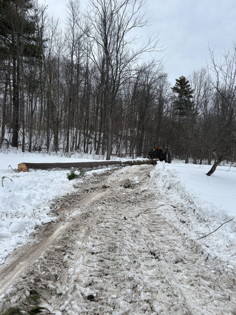
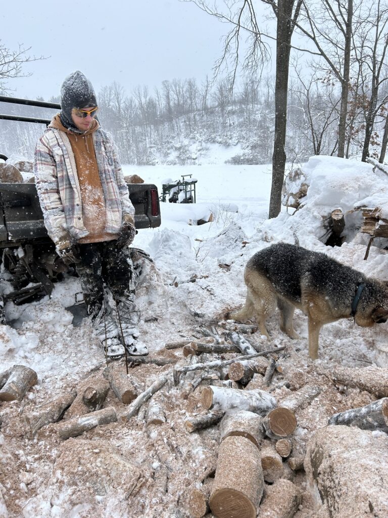
Last week I helped cut and get logs skidded out for my friend Mike. AKA: Mike The Mechanic. He’s agreed to attempt to repair an issue that I have with the tractor. I decided that helping get his logs out from the small logging over in a section of my uncles woods was a nice way to help him out. Not to mention being fun for me. His crew had downed a bunch of white pine and started trimming them to be skidded out. So I spend 3 days limbing trees, cutting a few, and hitching the winch cable from the tractor to the logs to get them out. It was tough work but something I truly enjoyed. A throwback to the days when I used to log with my dad years ago. Each day, I left the woods tired but with a sense of accomplishment. I also felt a twinge of remorse for the fallen giants of the forest and the damage to the understory below. The collateral damage I call it. But the grove of pine trees were beginning to die off some. Several showed evidence of the fungal infection called “red rot”. And others were being attacked by woodpeckers hunting for insects. All signs that a harvest would be beneficial and would be the best management strategy for the forest in the long run. We did quite of work in those 3 days and I enjoyed the time working with my uncles outside.
Uncle Art skidding a long white pine log.
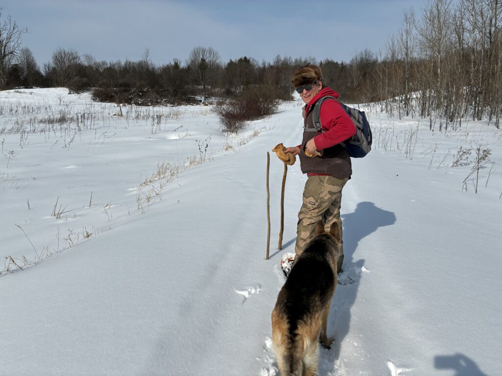
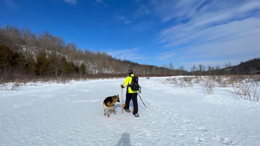
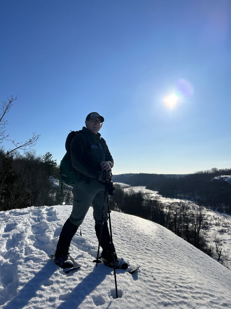
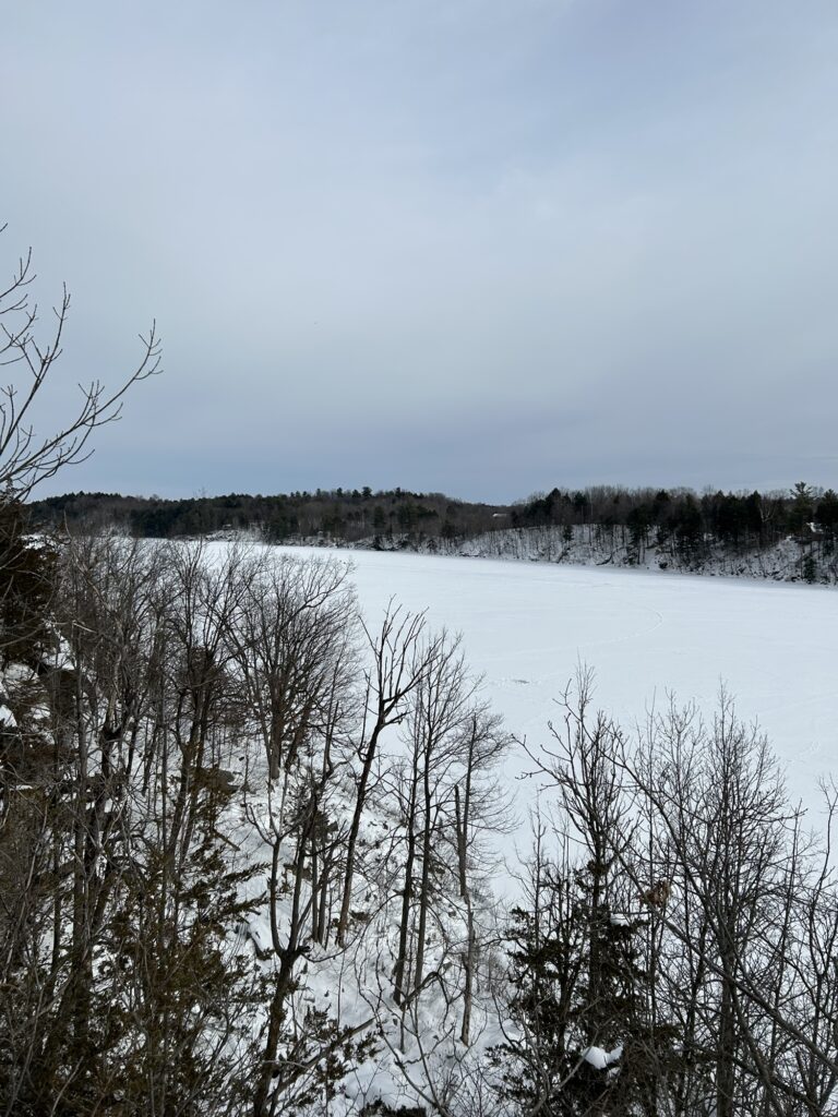
Before the logging work, I went snowshoeing with friend Scott “Polar” Force on the state land of Lonesome Bay state forest near his place by Black Lake. It was quite the adventure! The afternoon started sunny and warm for us as we followed a broke in snowmobile trail towards our destination. I was soon down to my tee shirt!
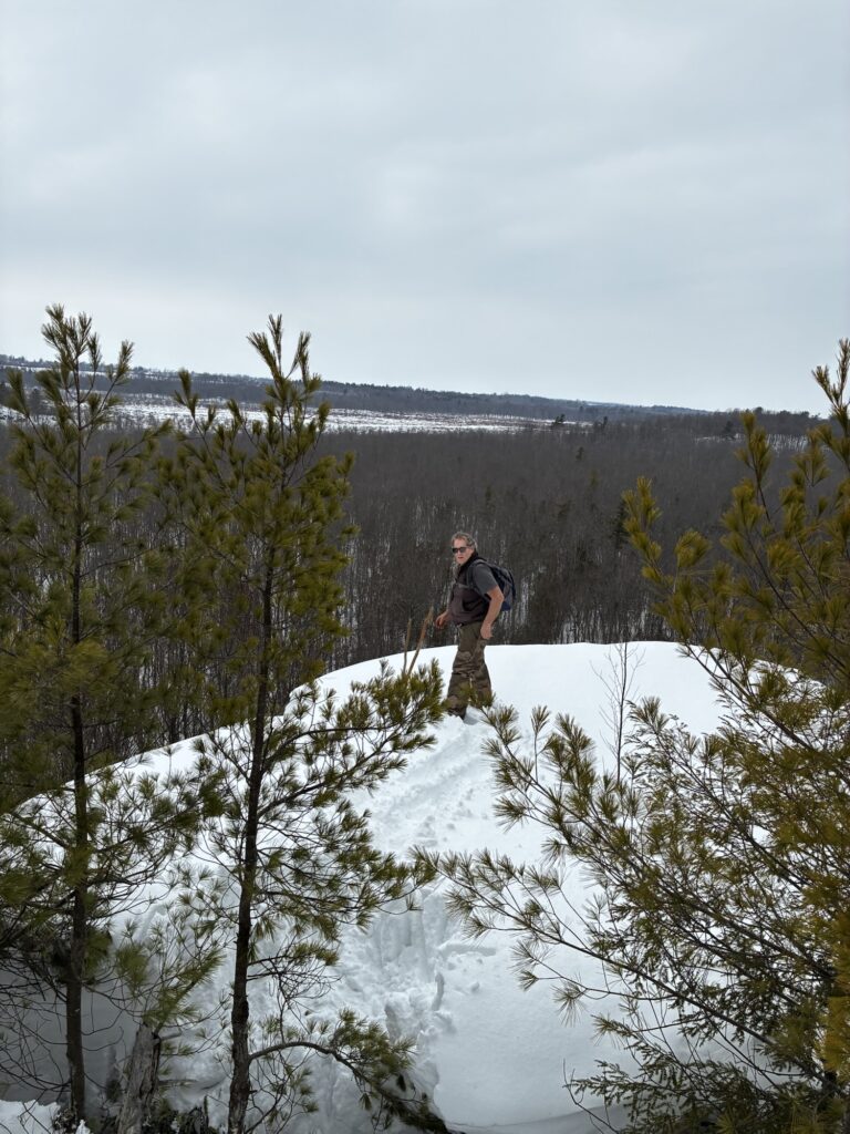
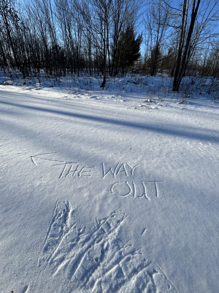
Our destination was a high, island like, projection that rises from the swamps of the Black Creek swamp system. Zane and I discovered it years ago while hunting geocaches. There’s a swamp to cross before you reach a remarkable cantilevered ledge that hangs out into space above the soft maple swamp below. I had bragged to Scott about wanting to show it to him. Time was limited so February was the only chance we would get to trek there. I knew that the deep snow was going to be a problem but figured with two of us taking turns breaking trail after leaving the snowmobile trail, that it was doable. Well let’s just say that we got our adventure alright! We even got a bit of swamp ice walking in on the way to the ledge. I got us a little off track getting there. I hadn’t been there since 2018. We ended up putting on some extra distance under rather challenging snowshoeing conditions. Oops!
On our way to the ledge.
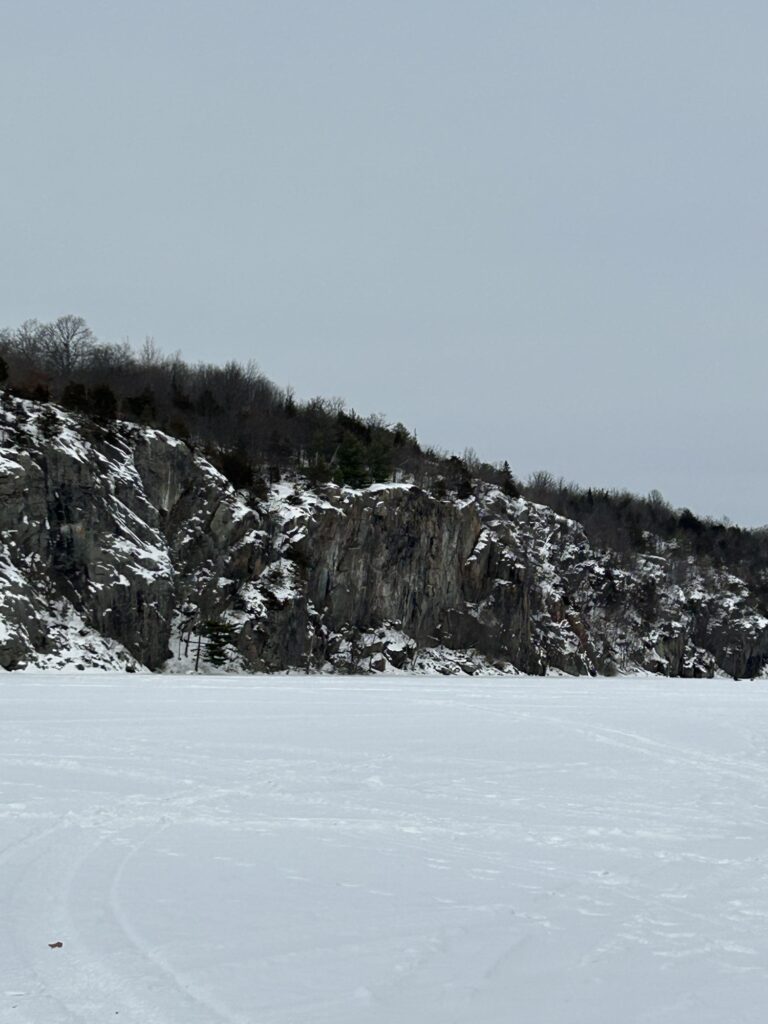
We finally reached the ledge in late afternoon. The sun had gone under and we were quickly running out of energy. I was afraid that I would not find the ledge but eventually we did. Getting out onto it was problematic as there’s a crevice that separates it from the main ridge. A little spooky actually! But out on the ledge from the high vantage point, it was totally worth the energy it had taken to get there! But we still had some distance to cover to return to the truck. Backtracking was not a good option as it would take us way out of our way. So it was a bush wack out breaking trail experience. One that beat both of us up severely. It was full on “zombie mode” getting back to the truck. But we had made the trip successfully! We celebrated with hot venison tenderloin sandwiches for dinner! Yum!
Out on the cantilevered ledge.
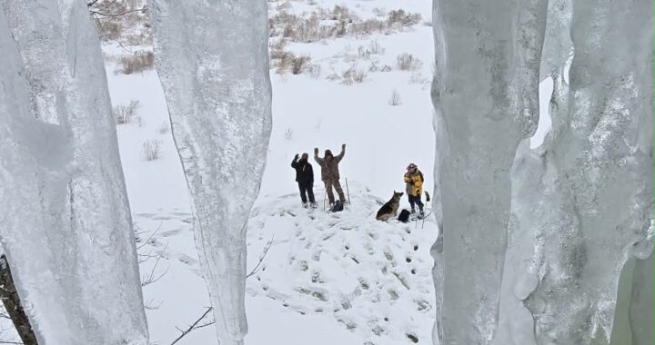
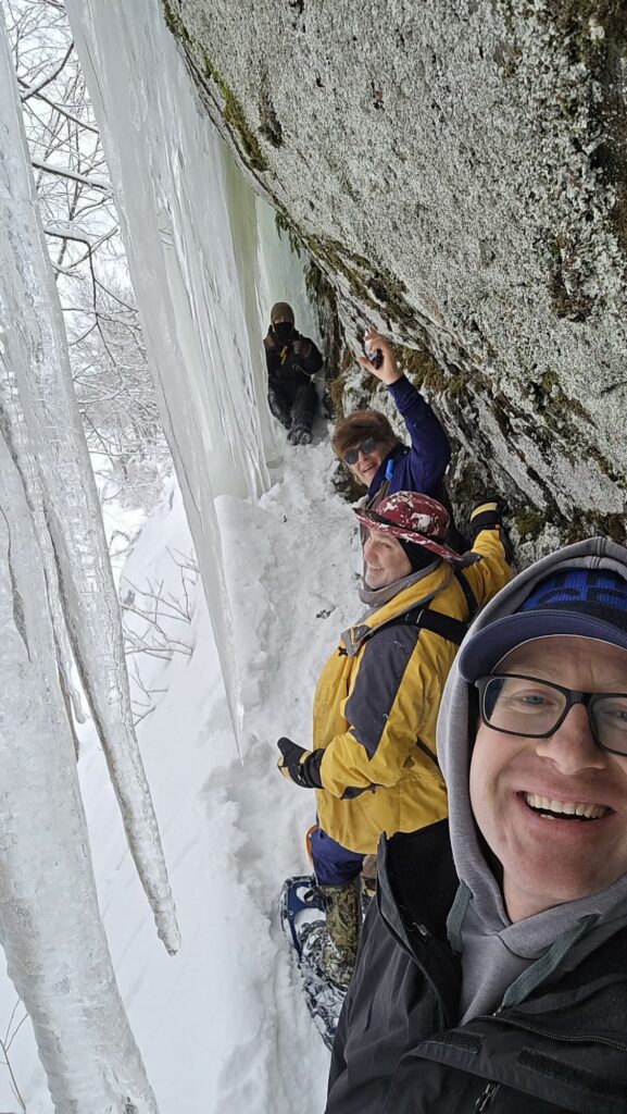
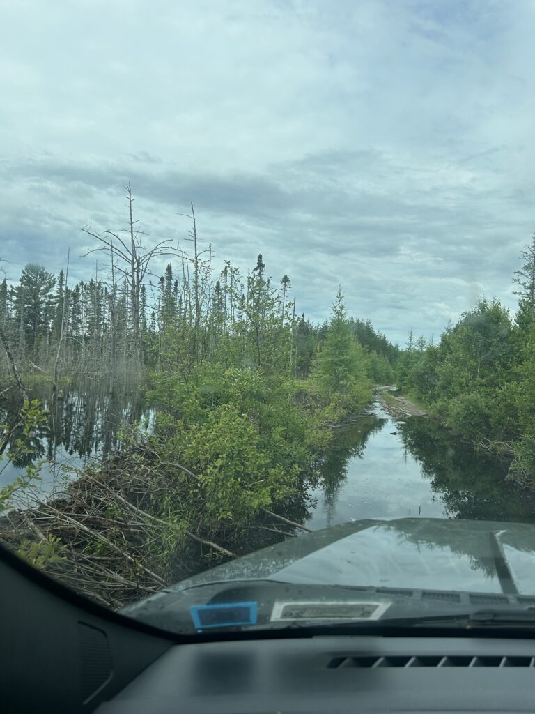
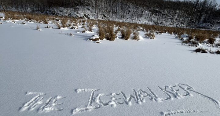
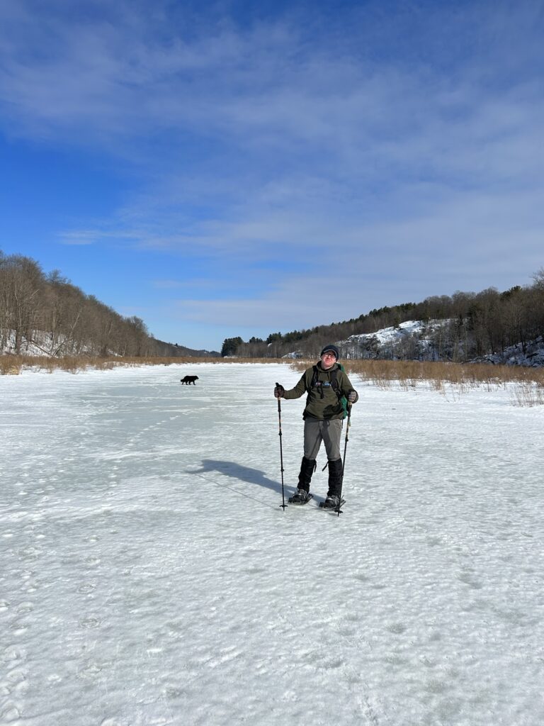
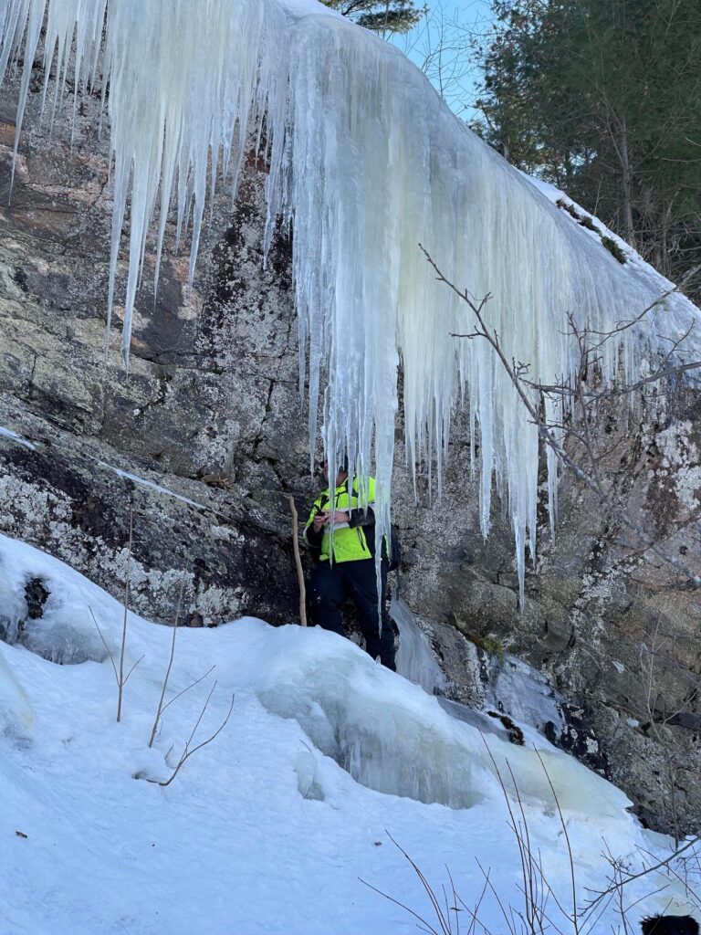
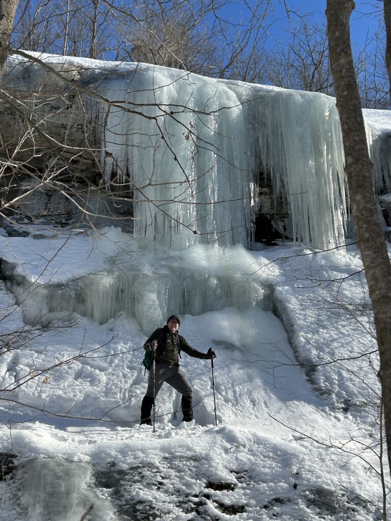
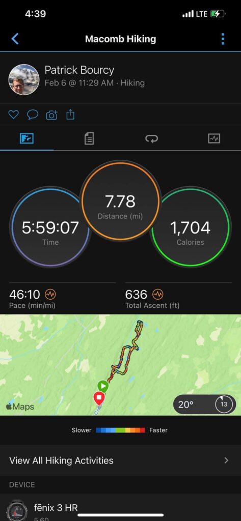
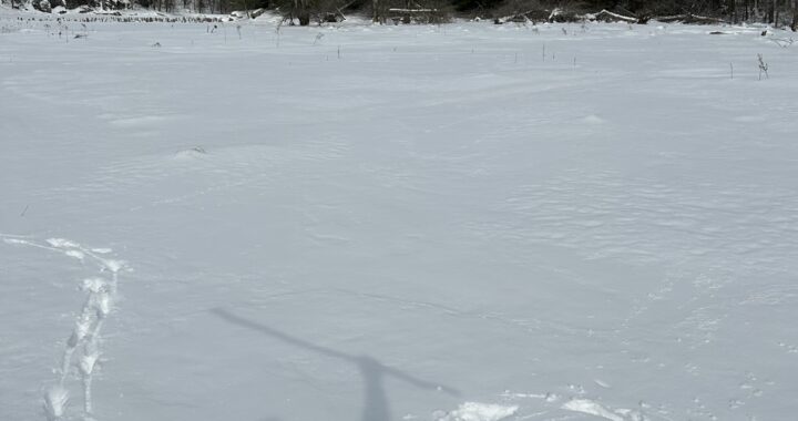
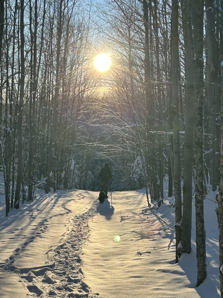
Last Saturday we decided to trek to the Ice Falls finally. Late February is usually a good time because if you wait too long the ice may not be there long in March. It’s a gamble and sugaring leaves little time for a trek. After my recent trip down on the ice of the big creek, I knew that Saturday’s trip would be challenging but was totally possible. But conditions had changed since I had been there. We would later find that out! Our group consisted of myself, Zane, Scott Polar Force, and Patrick Bourcy. Gracie also. She had managed the previous trek so I wasn’t worried about her.
We set out just after 11am under cloudy, cool skies with a brisk north breeze hitting us in the face as we hitched up our snowshoes. The trail from my previous trip was ok at first but soon became very slushy. Not good at all! Breaking a new trail wasn’t much easier but we kept up a slow and steady pace headed downstream, dodging wet spots and even some shallow, open water. We skirted an open breach in a beaver dam where the beaver had been out feeding on fresh brush. So far, no one had broken through. It was tough going in the slushy conditions but we were determined to make it to the Ice Falls. Despite the tough snowshoeing, I was happy to be exploring the gorge once again!
Beaver business around a dam.
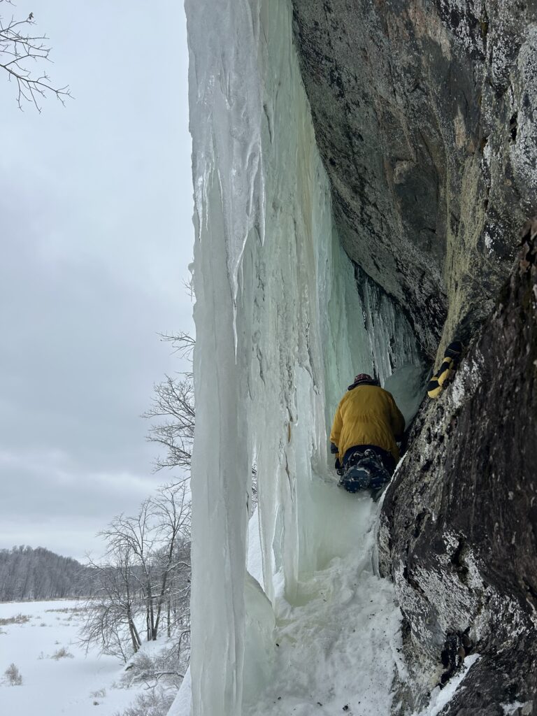
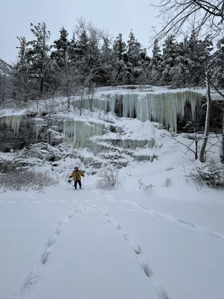
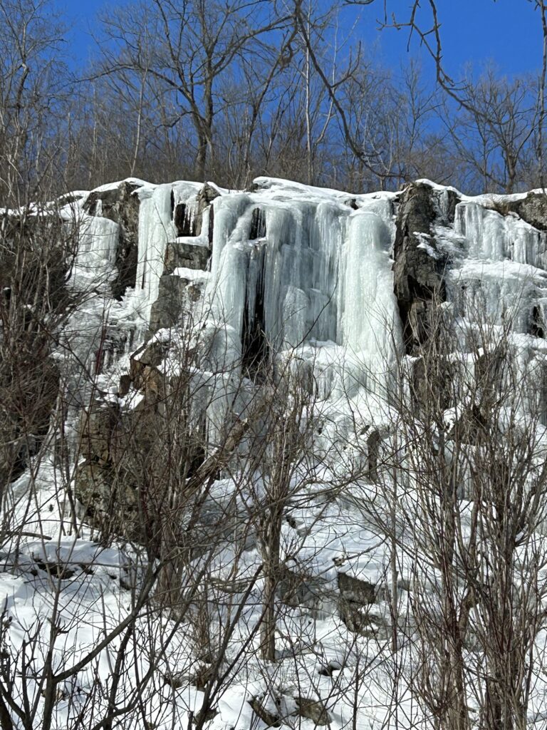
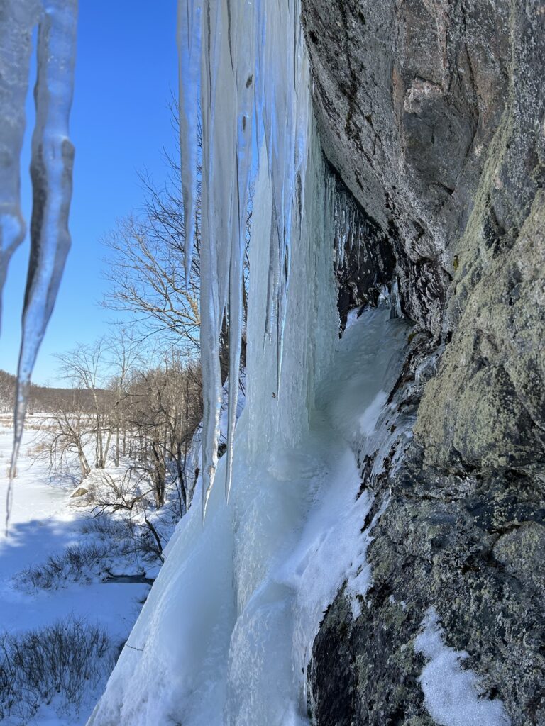
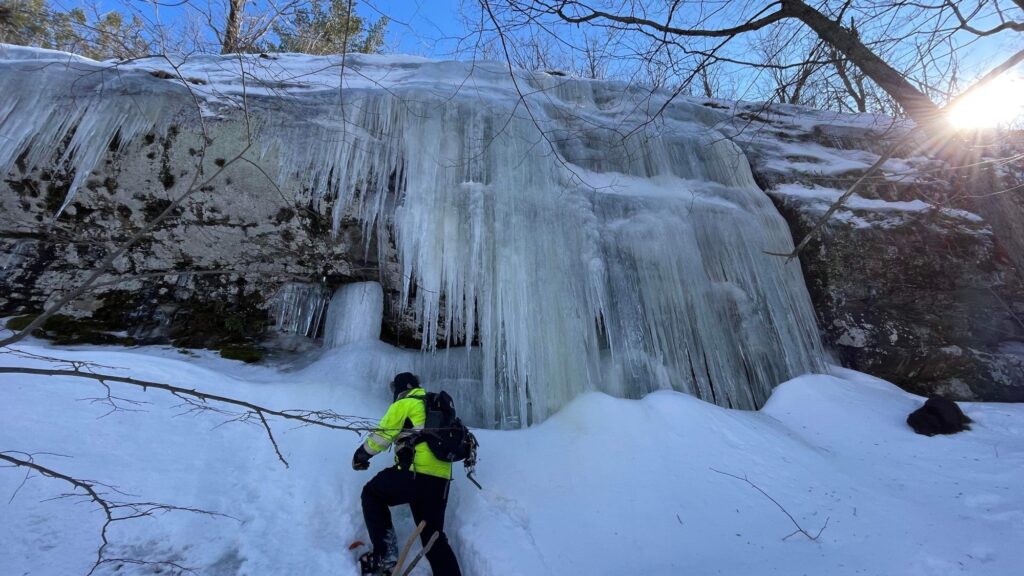
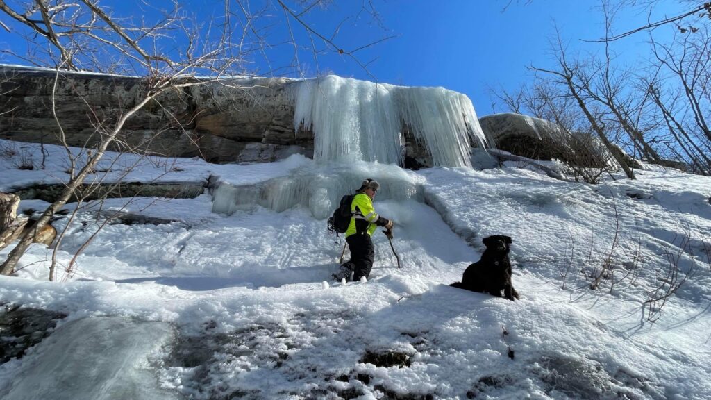
We eventually reached the first set of Ice Falls and they were totally worth the trip! We climbed up behind them like energetic children, laughing and taking lots of photos. The second set was equally amazing and we climbed up to them as well. Everyone was having a great time! I fell coming down from the second Ice Falls and face planted in the deep snow! Everyone got a good laugh over that especially Patrick! But I got the last laugh when he broke through a thin spot and soaked his leg filling his boot with water. He tried a shortcut it seems. Not so good actually! It happens!
The crew on set one.
We trekked down to Ice Falls Set 3 and they were impressive but we decided not to climb up to them. We still needed to trek our way back out. A journey of close to 2 miles although I always thought it was shorter. Everyone had a red face from the wind burn and people were beginning to tire some. Zane was cold and ran out head of us although I thought we should stick together. And the slush began to take its toll on our tiring legs. I started calling it Hell Slush after that. We sure were glad to reach the hard surface of the road! Zane actually soaked one of his legs on the way out it seems. I noticed where he broke through in a shallow spot.
Behind the ice.Set two.
Back at the cozy cabin, everyone hunkered down close to the wood stove while I fried up some walleye outside. Beans,potatoes, and pumpkin pie for dessert rounded out the bush fare meal. We were sharing stories about the adventure and life in general. We had made a successful ice walking adventure come true under rather tough conditions. But we quickly forget about the hardships when we look back later at our photos and reflect on the moments.
We certainly know to respect the Icewalker’s Motto: The distance in, must be traveled out. A favorite quote of my creation years ago. Easy to say but not so easy to do sometimes. We like the challenges and adversity I feel. It brings something to an outing. Those moments when you look back at where you have just finished exploring as late afternoon ushers in the coming evening while the cold breeze nips at your face. You realize your frail nature and smallness in the face of nature. Your body would not easily survive a night out on the frozen surface of the swamp. The need to get out becomes real and very primordial then for me. That’s a big part of the experience for me. Something I chase. Something I have always chased even when I didn’t realize it. It’s something that touches my inner spirit in some strange way. An Icewalker’s gift from nature perhaps. But any location out in nature can gift something similar really. But the ice under your feet that holds you over the freezing water below, is something more. A flat path of quick travel at times or a slow, cautious push forward to hard reach destinations. This truly describes the annual Ice Falls trek I believe. Never the same experience although the location remains the same. Different ice below you and different ice hanging above you.
For me an ice walk is meditation through my feet. Step lightly with reflexes tuned in to the slightest movement or cracking sound. Tapping on the surface with my beaver stick trekking poles , probing like a blind person for hidden dangers. It’s something like that only much deeper. I never grow tired of sharing it. It is enough. ✍️
Yesterday was Winter Solstice! Now the daylight will begin its slow return to later sunsets! Earlier sunrises too for that matter. Regardless, it’s a slow process at first but it will become more noticeable in time. For me the best days of winter often come later in the season.
I have gotten ready for Xmas and didn’t wait till the last minute to do my shopping like I did years ago. Ordering online sure has helped with that! We cut a Xmas tree just over one week ago and it was a fun outing despite the deep snow near St. Regis Falls. We were unable to get a balsam so we settled for a white spruce that was around 7’ tall. It’s a nice tree and it provides a truly traditional look to the house.
As the year draws to a close, I find myself reflecting on the months now past much like I do most years. I decided to do a writing and photo series on Facebook that I titled “The Year In The Rear”. It doesn’t really interest people to be honest. But neither did a similar project I did last year. That’s ok, as I find taking the time to reflect on the months now past a good writing exercise overall. It’s beneficial to observe my activities month by month to gauge where I invest my time. True to form, my activities are quite predictable actually, following the seasons that include my favorite hobbies and annual adventures. I suppose at some point you could stop reading the blog and pretty much guess what I am up to at certain times of the year. But don’t get too comfortable doing that as I may surprise you from time to time. And while many of my activities are typical for me, the individual stories and memories that are made are quite different indeed. And this past summer was far from ordinary!
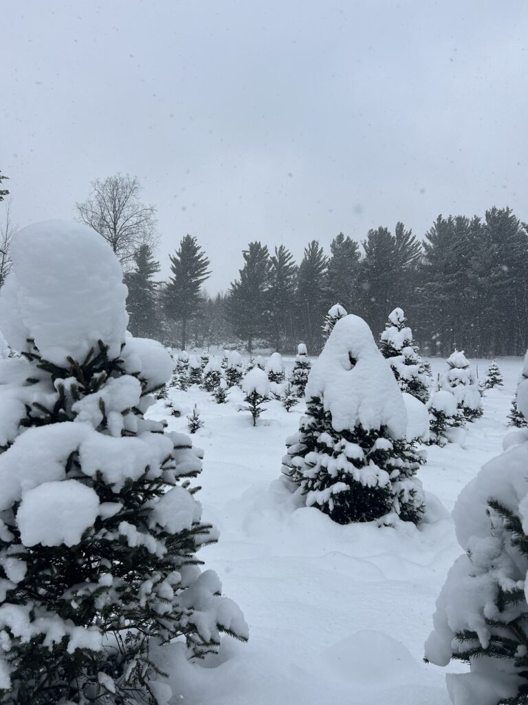
Lots of snow in the Adirondacks!
As my posts would indicate, I spent much of my summer chasing adventures in Canada, living in the Airstream out of a base camp setting in Quebec. What a great experience! And all these months later I still haven’t shared all my stories about my experiences! As winter settles in and I spend less time outdoors, I find myself wanting to write more about those experiences. And one thing you will notice is me jumping around on the timelines. Think of it as time travel of sorts. A jump from the now to the past and back again in a grand spin of time. Time travel isn’t possible in real life (although some scientists will disagree) but in writing it poses no problem. With some words,I could accurately describe a future location where I will be going this winter and hopefully make you feel like you are there. It’s easy to visualize the now. And with photos from my gallery, it’s easy to portray a journey back in time. No big revelations there I guess. Writing in chronological order doesn’t necessarily suit me it would seem. It’s time to share an adventure from last July. It’s a place quite familiar if you’ve followed my blog any length of time. But the circumstances were slightly different. I made a sudden decision one day while in Quebec shortly after returning from the states with my small boat and followed through with it. I was tired of waiting for good fishing success to find me! Why wait I thought?
It didn’t take me long out on the big lake at the outpost ( Kipawa Lake) to realize that fishing was going to be challenging for me. Some early success was followed by some struggles to catch walleye. The lake trout fishing was equally challenging for me as well. I tried new locations and explored around the lake but I just wasn’t having any degree of success. Other fishermen at the outpost were doing better but they were traveling some distance to make decent catches. And the sheer size of the lake was often a little daunting in my 14’ boat. Wind and big waves were a detriment and a deterrent on several occasions, keeping me from going out fishing in the first place. I was beginning to get a little disappointed with my decision to place myself on such a large lake. Something needed to change! I decided that I wanted to go to a place I knew well and try for walleye!
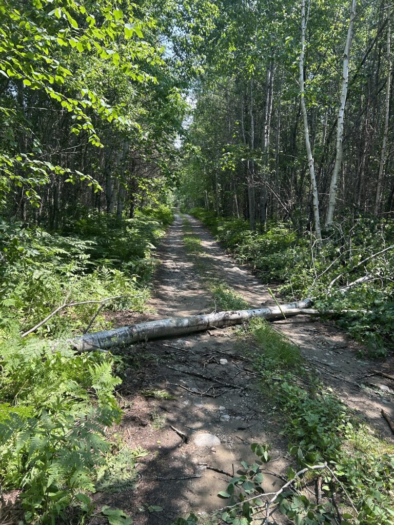
Tree across the road back in the bush!
I made contact with the outfitter where we were going to be spending a week in late August ,on our annual trip fishing trip ,and asked if I could rent a boat and camp on an island there. It was too rough a journey in to beat my boat and trailer getting it there so renting a boat was necessary.They said no problem but there was a cost to camp and to fish in the lake. When I factored in the costs and the fact that the bugs were still so bad,I began to reconsider camping. I asked if any cabins were available and they said they had one that I could rent near my preferred location on the lake. I had seen the cabin from a distance before but had never been inside it. They said that the water and fridge would be turned on for me if I wanted to come for a few days. It was a no brainer really for the added cost to the trip. I said yes and booked a three night stay. I would have more than enough room and all the amenities! Why bother camping? I began to prepare for my departure on July 2nd.
Getting to the landing of the lake where I would pick up my boat for the trip to my cabin would be an arduous 4 hour drive total. The logging roads get worse the further you travel in on them. I was very familiar with the main dirt road towards the outfitter for the first 38 kilometers. It’s was the “819” that I had been traveling since arriving in Quebec and I knew those first kilometers would be the fastest and easiest. After that things would slow down considerably. I made sure that I had my bow saw and brush nippers loaded into the truck. Sometimes on previous trips we have needed to use them. All part of the adventure. I was wondering what the conditions of the roads would be as there had been a couple windy thunderstorms in the last few days. And there’s usually beaver dams flooding sections of the road. It’s always a gamble!
I left late in the morning ,right on schedule, on July 2nd as planned. I had my bait, food, and everything else I knew I needed from previous trips. There’s no getting anything once you’ve there! The road was good until about half way in and then I had to start getting out of the truck to cut back brush that was hanging into the road. No doubt from the recent storms and apparently no one else had been through yet. At one point there was a big black spruce most of the way across the road that took some time to clear away. I had to continue to stop more frequently as the journey continued and I was getting overheated, not to mention the attacking mosquitoes that would find me. I did eventually reach the outfitter after a 5 hour trip to reach the landing. Step one was complete!
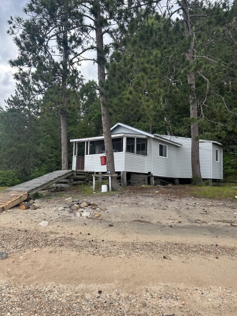
Cabin 3.
The outfitter and his daughter were at the landing fortunately. They helped me get loaded up while we talked and caught up with life. We know each other fairly well now. I was happy to hear that they had gotten brand new Yamaha 15 hp outboard motors. These modern 4 stroke engines sip gas! Gracie took her spot in the bow of the boat which is typical for her.The boat was roomy but loaded. I had a lot of gear for one person it seemed! The lake was quite calm for the time of day so I expected that it would be a smoother boat ride to the cabin. It takes about 20 minutes to get there. At least I know where most of the rocks are located. That’s handy as the outfitter doesn’t always mark them well.I would be at my cabin in time to settle in and still make it out for the evening walleye fishing. Perfect! The outfitter had said that the fish were biting good in fairly shallow water. I knew exactly where I would be going as I know the lake rather well and we have several favorite spots. That’s a comfortable place to find yourself I feel.
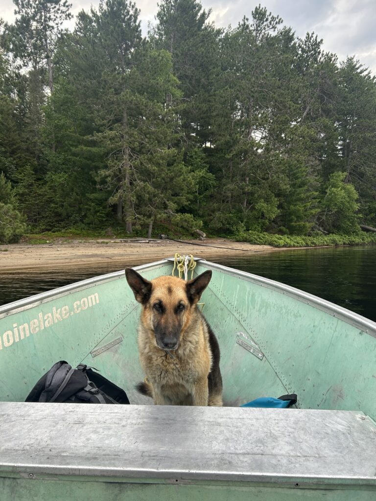
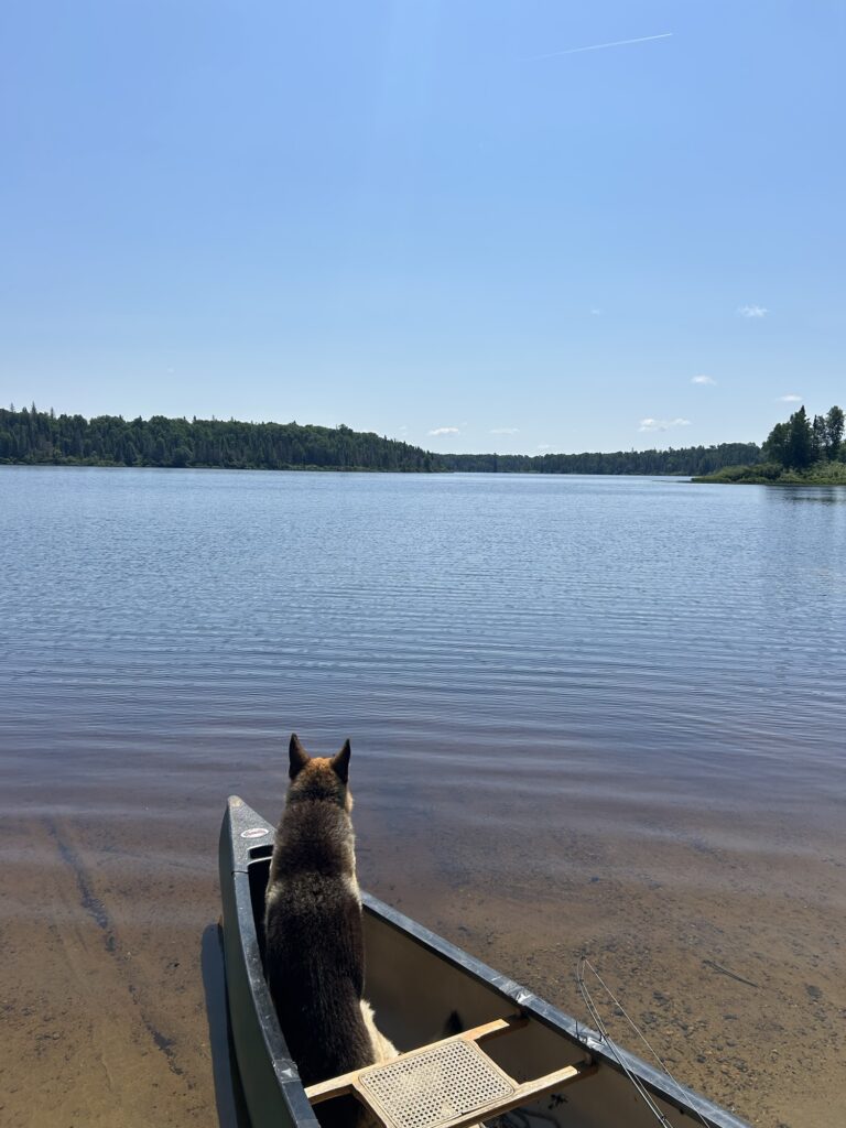
I found my cabin ready for me with a cold fridge and the water working. All was well! I didn’t care for the sliding entrance door though as it looked like mosquitoes might find a way inside. We will find out ,I thought.After a quick snack, Gracie and I headed out towards our fishing spot that would take about 10 minutes to reach. The lake was still fairly calm which is always a plus although we never mind the small waves we call “ walleye chop”. Minus our gear we zipped right a long at full throttle. We reached our destination and set up the fish finder to hit the depth I wanted, then dropped the anchor. It was nice to be back at the lake, anchored off an island at a place we call Raspberry Point. My timing was perfect for the evening fish!
Fishing companion.
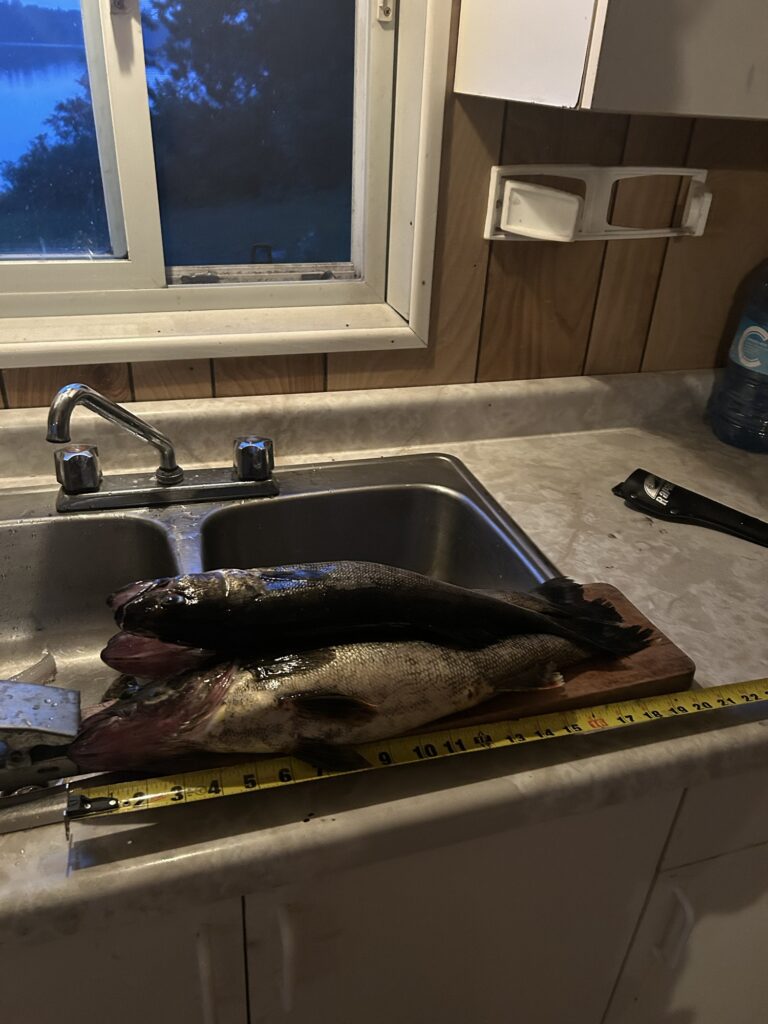
I quickly got my pole baited up with a leech on a bait float in about 15’ of water and settled in to wait for a bite. The fish finder showed some activity near the bottom of the lake. Usually a sure sign of walleye as they feed just above the bottom most of the time. The bite started slow but picked up soon. It was exciting when my pole nodded gently as a walleye toyed with the bait. I soon had one hooked after that! A nice 19” one that I had to net by myself. That can be challenging at times! I was really enjoying myself as the fish that were biting were decent sized. Well before dark I had 4 walleye in the boat. More than I could eat in one meal as they were all in the 16-19” range. I didn’t catch throwbacks at all. We call them Beckies. They’re the ones under 15”. Some days we catch lots of them. Due to my good fortune, I decided to head back early to clean fish before it got dark. I still had plenty of time to catch my take home limit of 6 keepers in the next couple days. After all the tough fishing on Kipawa Lake it was nice to get some quality walleye fishing in with little effort. I knew that I had made a good decision to come! I felt totally in touch with nature. A true hunter gatherer moment.
In the cabin away from the mosquitos.
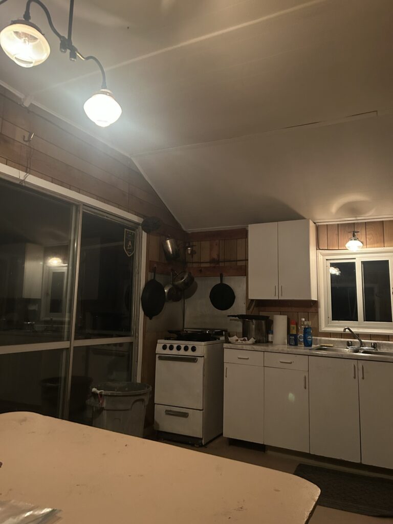
When Gracie and I arrived back at camp it was still light. Darkness wouldn’t hit until almost 10pm. The forest behind the cabin was alive with a buzzing hum. Could it possibly be all mosquitoes? I soon realized that yes that’s what I was hearing! And they began to swarm around me and Gracie. We retreated to the cabin and I decided to clean the fish inside. I made a dinner of fried walleye and potatoes as darkness finally settled over the lake as the last of the sunset disappeared from view. We were hundreds of miles from home and way back in the bush on a remote lake with almost no one around. There were some other fisherman in a cabin about a half a mile away and the outfitter was at the caretaker cabin past that. The night was incredibly dark and quiet except for the buzzing of mosquitoes. It was strange being there alone but I was ok with that. Later on, I turned out all the gas lights, then Gracie and I crashed out in one of the bedrooms and discovered that some mosquitoes had managed to get into the cabin. I killed a few and eventually passed out from exhaustion. It had been a long day!
The next morning Gracie and I woke up to windy conditions. After coffee we went out to fish but were driven in by the waves with no luck. Gracie doesn’t mind the waves usually but these ones were bad. We couldn’t set our anchor and get it to hold in our fishing spots so we went back to camp for brunch. I had frozen 2 of the biggest walleye the night before just to guarantee some take home fish. I wasn’t planning on eating walleye everyday but I was hoping to be able to catch fish that evening. We sat out the day doing camp chores and taking a nap at one point after getting a nice hot shower. This sure beat camping out! Time was already speeding by as it always does at bush camp.
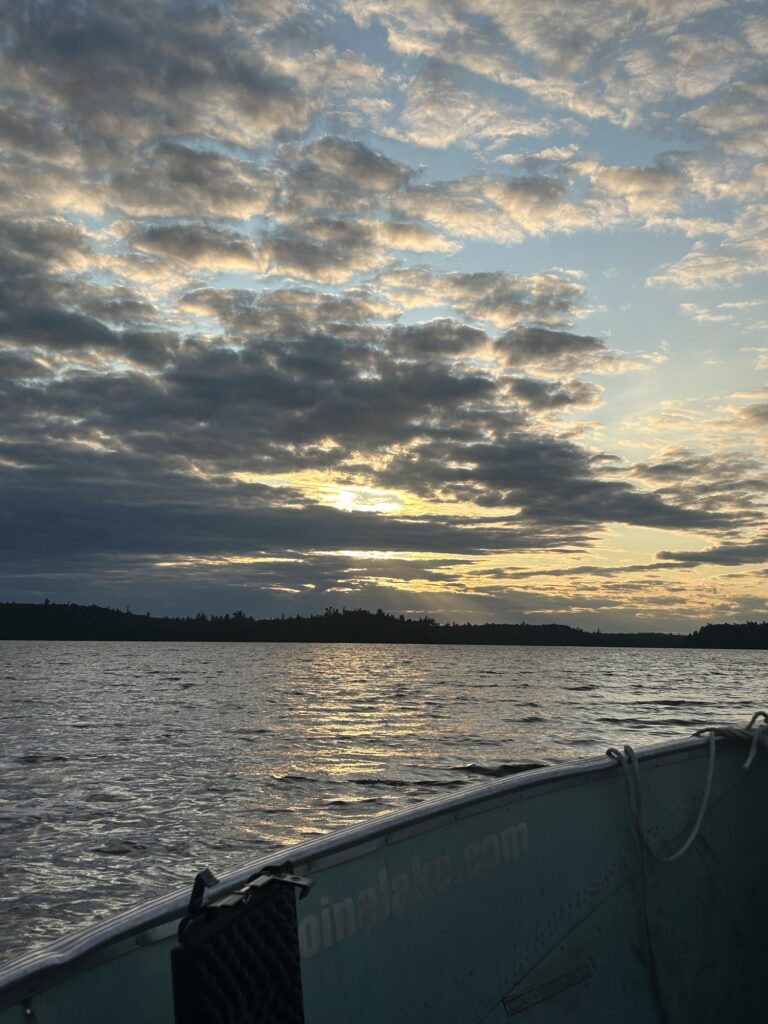
As evening came on the wind subsided some and we headed out to fish. It turned out to be a beautiful evening and the bite was turned on! It was none stop action! I caught some nice walleye and threw most of them back. The size was mixed but there plenty of fish biting and I went through a bunch of bait. I had worms and leeches but the walleye preferred the leeches. Luckily I had brought plenty! We headed back early again before dark and the sunset was wonderful! That’s always been a plus of this lake, beautiful sunsets! My walleye count was adding up and the less than perfect fishing on the other lake no longer bothered me. This was living! It was a little strange being there by myself but I had Gracie for company so I didn’t mind. I was able to call home on my satellite phone and check in so everyone knew that I was doing fine.
Out on the “Markers”.
It was another typical night at the cabin. I had closed up windows to try and keep the mosquitoes out but they still managed to get it. I had some fogger and put it to use around the screens and window frames. Fighting back against the mosquitos felt good actually. I realized how bad it would have been for me had I been camping out of a tent! I made walleye,beans, and potatoes for dinner. I put them on a plate together to create a dish that I call “The Hot Mess”. It’s awesome! And just like that it was bedtime again. I had a good screen on my bedroom window and had my window open. I could hear the buzzing of the bugs in the forest but it didn’t bother me. I drifted off to sleep as a bit of moon glow lit the clearing by the cabin.
I don’t know what time it happened but I awoke to hear a blood curdling sound of some sort. I believe it happened twice but I only really heard it good one time. I still don’t know what made the sound but it was big! I jumped out of bed really alarmed and grabbed for my fillet knife. I went to the window but saw or heard nothing. I had trouble sleeping after that and put my two knives within reach. Gracie seemed indifferent and not disturbed at all. What could have made that sound? A moose? A bear? A lynx? Or sometime that I decided not to think about! An alien! Or a Sasquatch! Needless to say I didn’t fall asleep right away. But the rest of the night passed without incident.
Night in the cabin.
The morning dawned calm and cool. After coffee I got out for some fishing and added to my total count. I now had my limit of take home fish in the freezer. 6 nice ones! My numbers were adding up and if things continued to go well I would leave the lake with some respectable fish catch numbers. Later in the day as I was relaxing in the cabin I saw something swimming across a narrower section of the lake near the cabin. It was a moose I soon learned! I chose not to take the boat over for a closer inspection and watched it until it disappeared onto the shoreline. After that the outfitter’s daughters came by looking for a section of missing dock. I helped them load it onto their boat and haul into place. It was pretty beat up but was still usable. I headed out for my final evening fish and it was another productive catch night! Everything had to be released though as I had all that I could legally keep. It was plenty and I had eaten some also.
The Hot Mess! Yum!
Gracie and I headed back early from fishing and I decided to have a fire despite the mosquitoes. The sunset was fabulous and next to the fire the bugs were tolerable. I didn’t have much firewood so I had to call it an early night once the bugs got worse. My final night in the cabin was uneventful and quiet. But I hadn’t forgotten about the unidentified sounds from the night before and my knives were close by!
And just like that my mini trip was over! It was time for the drive back out. At least the road was in better condition! I had caught an impressive 64 walleye in just three days! My techniques for fast catch, net, and release provide for the best possible conservation practices. Severely wounded fish make it to the fish fry or take home count. Protecting a lake like this one is important as they are not easy to find these days. I was feeling great about finally catching some walleye! I had truly enjoyed the solitude and quiet time away from everything. My accommodations had been simple and adequate.The fishing had been a total rush for me! There’s nothing quite like watching a walleye thump cautiously on your bait! And the fight that follows if you set the hook! And of course who can’t be mesmerized up by the remoteness of the lake and the miles of undeveloped shorelines? The big skies and the always fabulous sunsets! I find the experience a total battery charging moment in time. There’s really nothing quite like it really! And when Zane and my friends are there too? Over the top fun! I hope to continue to do this for as long as I live! I truly love the bush country lakes of Quebec! ✍️
A rather chilly day here in Santa Clara as last night’s wet snow continues to melt. I completed a few small projects this morning so I figured it was a great time to share some recent experiences and follow up with part two of a story that I wrote a couple months ago.
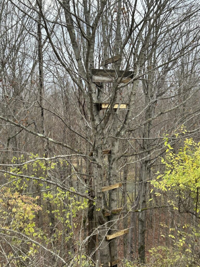
If you read my last post then you know that hunting has been occupying some of our time lately. We haven’t had any luck coming across any bucks but continue to see a few does. We have added a couple tree stand locations to our hunting strategy.Simple affairs that provide absolutely no shelter from the elements. Getting off the ground is totally beneficial. Last Sunday afternoon as I sat watch in a chair while scouting a new location, a deer spotted me soon after walking within sight. Busted! The doe didn’t get too excited but she did wander off in the opposite direction. Hiding behind a tree wasn’t enough it seems. I was too obvious it became apparent.
One of our simple tree stands before camo netting was added.
Autumn rain and winds have removed most of the leaves now around the farm property. I have spent some time clearing out sections of our old tractor roads lately. Totally overgrown with weeds and berry bushes not to mention fallen trees. What a mess! I also cleared out a bunch of invasive wild honeysuckles in several areas. The “ battle of evermore” I call it, borrowing the name of an old Led Zeppelin song. The title of a post of mine years ago actually. Zane and I have been discussing a long term strategy for maintaining the farm property. It’s going to take some time and effort but past efforts have yielded modest success. Various small clearings exist where the invasives once held dominion. Much still needs to be done.
It seems like it was a very long time ago that I was in Quebec fishing and exploring. I suppose the change of season has something to do with it. There have been quite a few different tasks completed since I returned home actually. But never enough, it can feel like on occasion. Getting back into hunting was a good choice and I remain committed to creating a nice hunting preserve on the farm Homestead. Trails, trees, and time. Perhaps the title of a future post?
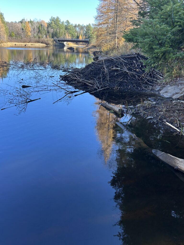
I go down to the St. Regis River here to see what a beaver has been doing since discovering it was living so close back in September. It’s a short trail to get to the river that I have cleaned out some for walking. Some of it was an old road once but it’s almost unrecognizable as such. From the top of once was an old bridge foundation, there’s an excellent view of the river. Off to the right sits an old beaver lodge that a beaver has taken over in the past few months. At the moment it has been extensively repaired as the beaver prepares for winter. I say beaver in a singular sense as I have sat by the river several times until dark and have only seen one. There could be another I suppose but based on the size of the winter brush pile that the beaver has accumulated next to the lodge I estimate only one. The brush pile is small if there are actually two beaver. I sometimes cut some small poplar near the house and leave them as offerings for the beaver. They always disappear along with brush I cut from the trail. Handy for both of us! Going to the river is quick and easy for me. It’s a nice respite when there’s not time for a longer jaunt.
The river beaver activity.
Watching the beaver activity here makes me think about my camping trip in Quebec that inspired the post “The Damnation Of The Beaver”. I certainly got peeved at the beaver on my journey into the lake on our two day camping trip! If you read that story then you know that I left the story as I went to bed on my first night at Lac Sairs. Out of firewood and wondering what to do to solve that problem the next day. TP Island had its downsides besides toilet paper left all over the place! But I was committed to staying another night.Consider reading that post if you haven’t if any of this is vague. That should fill in more blanks. I now rejoin the story as I wake from my first night of camping at Lac Sairs.
Morning came after a somewhat restless night and I was very sore from sleeping in the tent with no air mattress. No pillows either. Something that never bothered me years ago. I didn’t need a fire to make coffee as I had brought my butane rocket stove. It works well for cooking too. After coffee and morning camp chores, I headed to the rift drop off to try for walleye. I only got one small one though. After trying fishing for a while longer without any luck,I decided it was time to decide how to spend the day. After my rough night on the hard ground I wasn’t feeling up to my original plan of portaging the river rapids and trying for the Turner Chute. Something seemed off about the idea anyway. I can’t say for certain what was causing the misgivings. Something was creeping me out about the whole expedition. I was kind of torn about it but in the end I listened to my sixth sense. I decided to table the adventure until I had someone else with me some other time. My body wasn’t up for it at any rate so I followed my gut instincts.I wouldn’t be reaching the falls in 2025 unfortunately.
The rocket stove.
After some late breakfast I decided to paddle down the lake to explore a couple distant islands. The lake was fairly calm and I knew that my upper body could handle the trip no problem. Lugging Gracie around has its pros and cons. Her weight holds the front of the canoe down nicely. Handy when it’s windy. But 85 pounds in the front is a dead weight to paddle around when you need to paddle into the wind.
I tried more fishing but it was a bust. The fish finder indicated that the bigger section of the lake was rather deep. 30’ plus in most spots. I bypassed the first island and approached the high ridge of the second one nearby. It was high,rocky, and covered with pines and a mix of hardwoods. I figured that there might be some good firewood to be found. We were going to need some or have an evening without one.
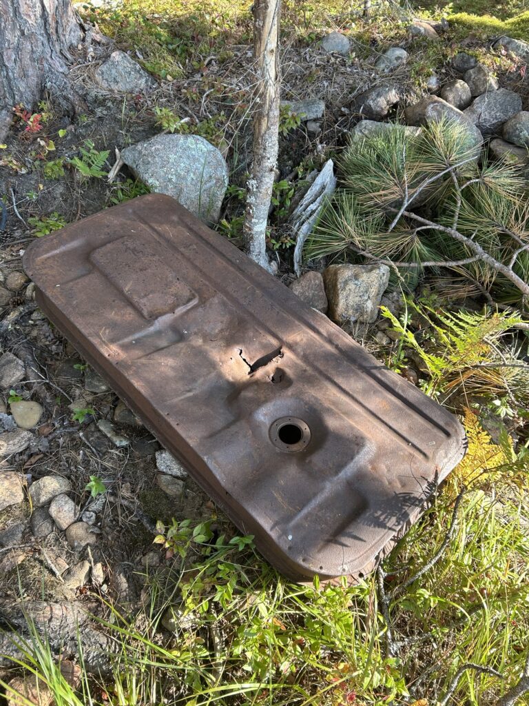
As we rounded the curve of the island, I noticed a nice beach landing where there was an unoccupied campsite. There was a lower fire ring closer to the beach and a higher one up in the woods. There was a small amount of garbage laying around but much less TP than on TP Island. People were being a little more considerate here. There was a small pile of cut firewood near one of the fire rings that I decided to load into the canoe. Plunder of a sort. I bagged up some garbage to take out as a trade. There was an old fuel tank from some unknown vehicle or something laying in the rocks near the beach. Oddly out of place I thought. I had time so I decided to scout the island more.
The fuel tank.
Near the beach there was a trail headed up to the ridge. It was well worn and obviously used frequently. I hadn’t ventured far up the trail when I noticed that some rock piles looked man made. Further investigation revealed excavations and evidence of some simple mining. There were some interesting green rocks laying around and I put several nice pieces in my pocket. The green mineral deposits were in the face of the excavation running in what appeared to be veins. Interesting! What was all this about? I certainly hadn’t expected to find anything like this on a remote Quebec lake in the ZEC territories! But things were about to get even more interesting!
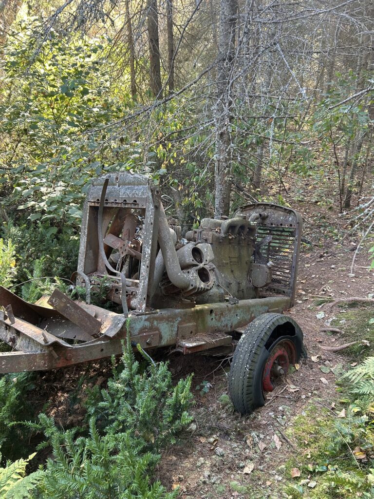
Further up the ridge there were other excavations hidden in the trees. I spotted something lower down in the trees and went to check it out. What I found surprised me! It was an old abandoned air compressor. The type used to run jackhammers and rock drills. Someone had been seriously mining on a small scale here! But why had they abandoned the air compressor? It must have been a costly piece of equipment to get out to the island in the first place.
The air compressor.
I was perplexed by the green rocks and finding the air compressor really got me thinking. There was more to all of this than I was seeing. At this point I was happy that I had abandoned my quest for the Turner Chute. I had been led to the island to discover something different. Spirit energy can nudge us at times. That’s what I chose to believe anyway. Gracie and I left the island with the wind picking up some making for some tougher paddling. But we eventually arrived back at TP Island after stopping to investigate another campsite near the mouth of the river near the rift. We were needing an anchor to better fish The Rift and I had an idea. And we still needed firewood for the evening. But it had been a great morning and I felt that the island mine had been a noteworthy discovery! ( to be continued) ✍️
It seems like months instead of weeks since I was in Quebec. There’s been lots of catching up since getting back home. I returned with the Airstream on September 15th after a 6 hour trouble free trip. The trailer sure does tow nice behind the truck! What a nice pair up! I reached the Homestead late in the afternoon and decided to camp out next to the cabin. I was pretty beat from the fast trip home so it seemed like a logical choice.
Made it!
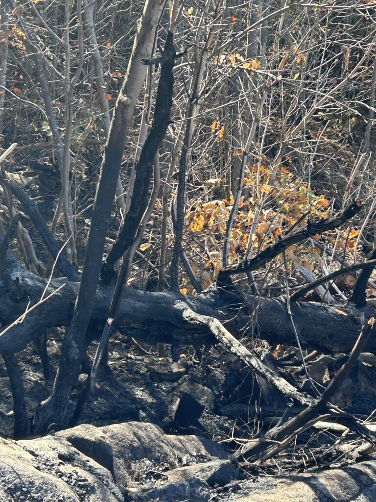
I soon learned after arriving at the Homestead that there had been a small forest fire on the mountain near the farm. It was contained to about an acre thanks to fire fighters getting there and getting it under control. It’s unclear what exactly caused the fire as there was no storm activity or lightning that night I was told. Fortunately the fire didn’t travel too fast or do much damage. It’s ironic that a fire occurred on the mountain as many years ago fire had destroyed the pine forest that once grew there. Charred stumps of large pine trees have survived over many decades lying on the bare rocks. The pine resin acts as a preservative of sorts and prevents rot.
I walked around the forest fire site but could not find any clues as to the origins of the fire. A very strange situation and there may never be any answers to the mystery. The small burned area provides an interesting study and it’s easy to imagine what the landscape might have resembled after the last fire event over hundred plus years ago.
The remains of the forest fire .
Things had remained very dry during my absence but some rain finally came recently. The trees are shedding leaves a little ahead of time this fall it appears. No doubt due to the dry conditions of the past several months. The garden ended up producing some decent cucumbers and tomatoes. The squash did produce some but frost arrived before some were fully developed. I will see what I can salvage soon.
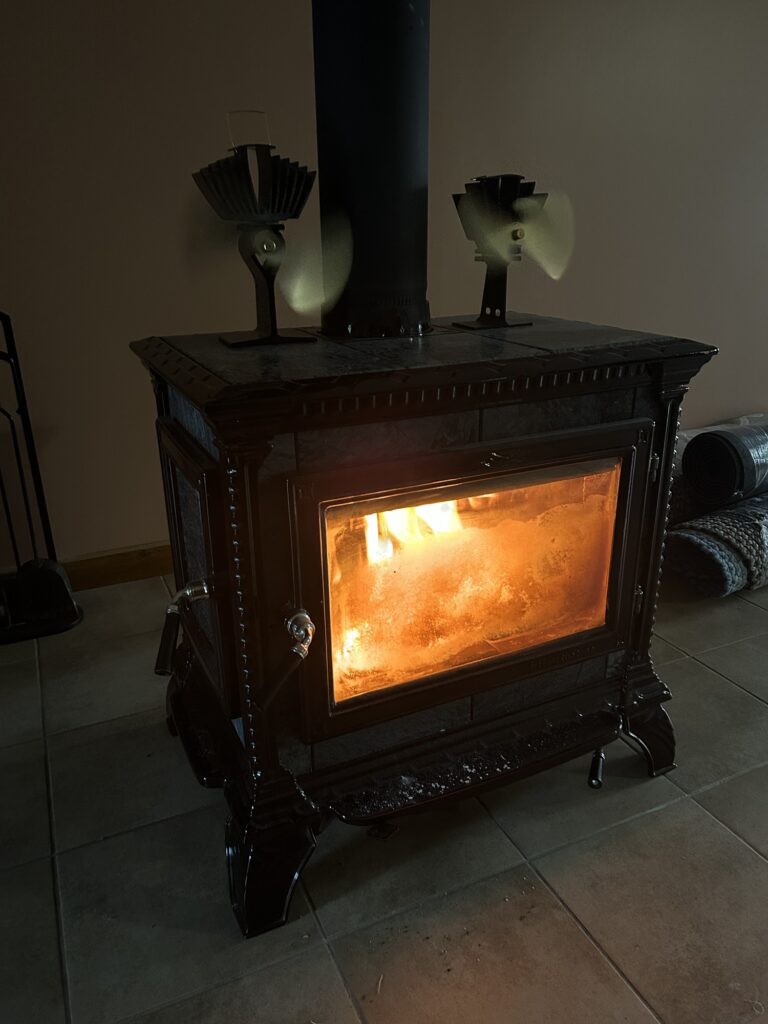
The big activity since getting home has been helping Amy prepare to move from Saranac Lake to the Santa Clara area. We began moving truck and car loads shortly after the closing. There were things that needed to be in the house ahead of the movers arriving last Friday for the main and final move. We camped out at the new house for a couple nights and tried out the wood stove prior to that. The wood stove is a beautiful unit with sandstone heat sink inserts. There’s an abundant supply of dry,split firewood that came with the house so that was a nice bonus!
Nothing like a nice fire on a cool morning!
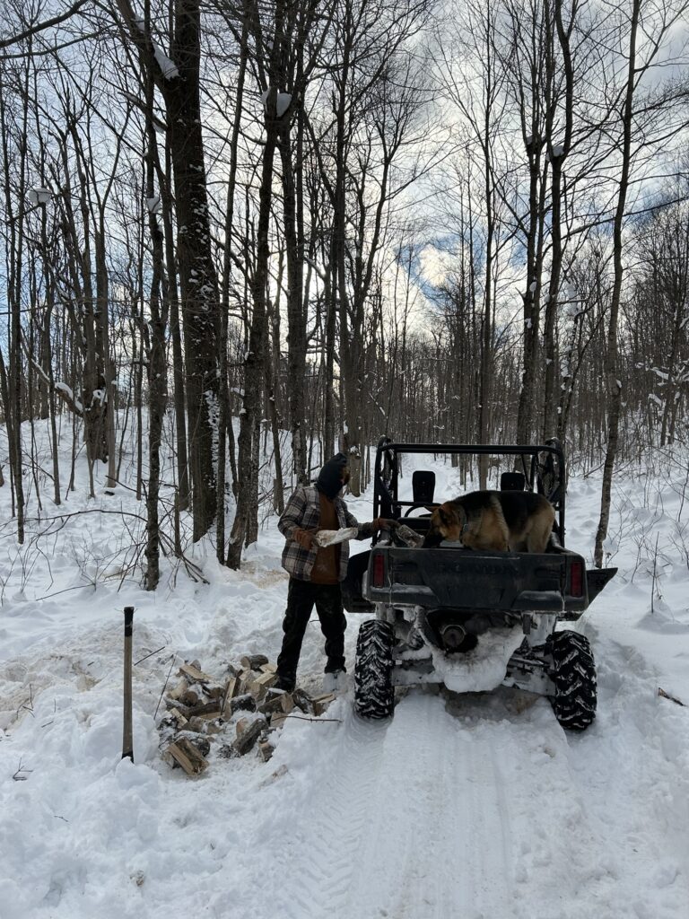
I have managed to do a few things around the Homestead as well. I got the wood splitter going and split up some wood for the tiny cabin. There were only a few pieces left in the back wood storage lean-to that’s attached to the cabin. It holds about a cord or so. The tiny wood stove in the cabin takes really short firewood. 8”-10” works best in it. I got the wood from the rather messy warehouse log landing. It really needs cleaning up. There’s all sorts of loose blocks of various lengths stacked up in random criss cross fashion. There are full length logs lying on top as well and in the bottom are partially rotten pieces that have been there for years. I am hoping to focus my attention on getting it cleaned up before heading afield for new logs. I would like to start out fresh there eventually.
Camp Edith is home still for the moment when I am not up in Santa Clara. It will need to be closed up and winterized sometime soon as today is October 1st. We won’t be trying to break last year’s record of staying there until well into November. That was fun though! And I was working at the time as well.It was a handy base camp!
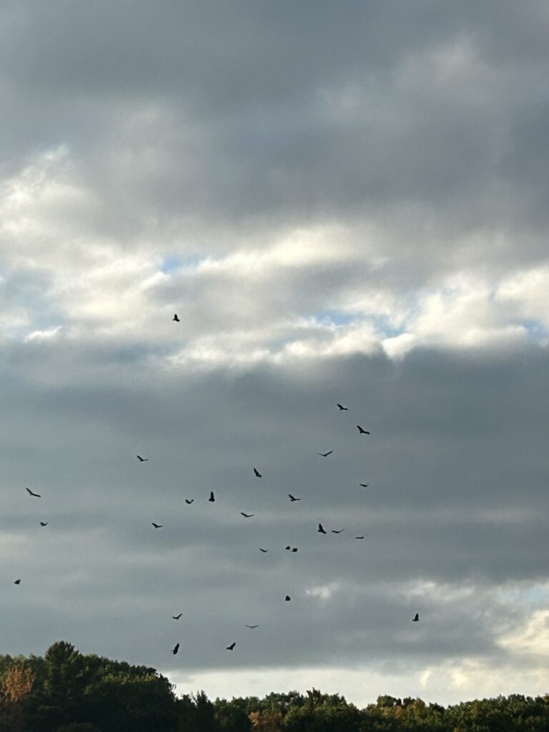
There has been some unusual bird activity on the lake in front of the camp recently. Ducks and geese weren’t anything out of the ordinary but the big group of gulls and cormorants one day were. They were all over the place and highly energized in their activities. I caught them on video actually. Last week a large group of vultures were circling around over Bigge Island. I counted 60 at one point before they began to disperse. Very strange! Is all this attached to autumn and the annual migration season? I believe that must be the case.
The vultures over Black Lake.
Autumn seems to be ramping up quite quickly now. Nighttime frosts are becoming more common. Last year the frosts didn’t come until almost mid October. Many leaves have already dropped and we will soon pass peak leaf viewing in the Adirondacks. The St. Lawrence Valley is a little behind but the color is well underway here as well. Soon the lawn at camp will be covered with thousands of leaves but the two big maples beside the camp are still retaining them at the moment.
We have begun to explore some of the Santa Clara area in the past few weeks. We hiked a small mountain known as “ The Pinnacle” early in September and hope to return there soon. It offers nice views of the surrounding lower lands. We also paddled up the St. Regis River exploring the lake like sections near Route 458. It’s the remains of a former reservoir I was told but much shallower with the dam mostly gone now.There’s much more water to explore upriver. Downriver is a different story as there are a series of waterfalls and rapids. Those can be reached on foot.
The upper St. Regis River.
Near the house we have found a neat place for a short hike on a very nice trail that leads to the river. Apparently it was an old road once. We found some beaver activity nearby around an old beaver lodge that was once housing for a much larger group I believe. The beaver has done a little winterizing on the lodge with fresh mud and sticks but only halfheartedly in my opinion. Out front of the lodge there is a small pile of fresh sticks that the beaver has begun to assemble for its winter feed pile that will eventually freeze into the river. There is no need for a dam here as the river is wide and deep. I am speculating that a solo beaver is living here. A hermit beaver they are sometimes called. Maybe a retired one as well. One that no longer has to maintain dams and cut enormous brush piles to support a big family group. But I am only guessing.
The beaver lodge by the river.
I have been leaving some small brush for the beaver on the edge of the river and it has been cleaning it up for food. Yesterday I placed some in the afternoon and returned just before dark to try for a glimpse of the beaver. And to test my theory about the actual number of them living in the old lodge.
It was a beautiful evening as the sun set through the woods behind me. Fish made ripples on the surface of the river but remained out of sight. The afternoon’s offering of some fresh popple ( aspen) had not yet been touched. My timing was perfect I believed! I saw nothing for a few minutes from my high vantage point on the old bridge foundation and I remained perfectly still. My patience was soon rewarded as I saw ripples form in front of the beaver lodge as a beaver suddenly surfaced. I waited for it to swim my way but it was on an upstream mission. I watched it fade off into the distance intent on some sort of beaver business beyond my comprehension perhaps. I could surmise that it might be touring its territory in a show of force. Not uncommon behavior for these big rodents. I had seen a territorial mud scent mound upriver just the other day. But I was only guessing.Who knows what drives a beaver’s motivations?
It soon became obvious that the beaver was not going to return before dark but I waited in case a second one was around. And I suddenly saw some more ripples near the lodge! But it was only a muskrat. The muskrat disappeared under the water and I presumed it went inside the beaver lodge after. Maybe it lives there with the beaver! A natural odd couple possibly! But who knows for sure?
The beaver headed upriver.
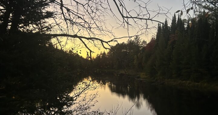
Off to my left,the water flowing down the rapids echoed up the valley surrounding the river as the evening traffic quieted down. I could hear birds and a larger animal in the forest directly across the river but no living creature showed itself. And the light of the setting sun cast a golden glow in the forest behind me as a beautiful reflection revealed itself in the river before me. One that a photo can capture but never truly gift the viewer what the photographer experienced. It was one of those rare moments when everything was perfect. The light, the sounds, and the smells that only autumn can bring. Soft mossy ground below my feet and slowly flowing water carrying fallen leaves downstream. And the passage of time became so vividly apparent to me in that moment. For the time that was the now past summer had sped by in a flash , was being slowed for a moment it seemed. But I knew that time was not slowing down. I was, for just a moment. Perhaps a person needed to be there to capture some of that spirit energy.One of invisible flow attached to the air and water. Earth and sky. And all living things there engaged in harmonious synchronicity. It truly was a special moment.
The reflections.
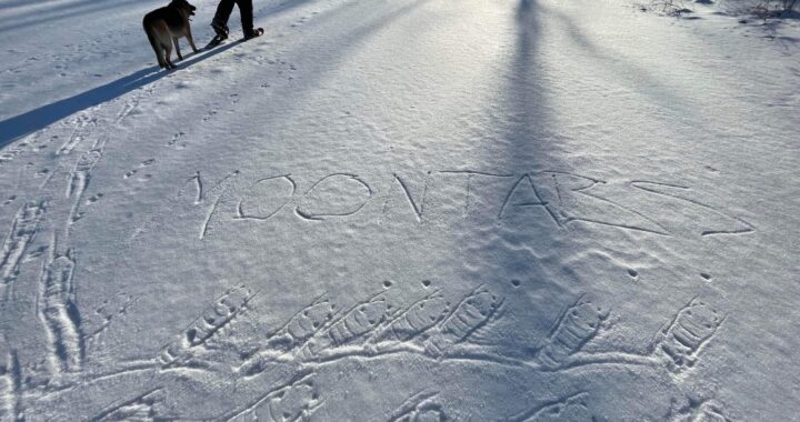
This short post will bring you , the reader, up to date on current events. But I have not forgotten the story that is to be part 2 of the Quebec camping trip post titled “The Damnation Of The Beaver”. I need to tell that one properly, for a great discovery was made on that trip. There are a great many stories that I have not told it seems. And might a post titled “ The Salvation Of The Beaver” someday become a reality? Who can say for sure? Beaver sticks yet hold their charm for me as I hold them as my trusty hiking poles. And I continue to seek to add them to my collection. Are there not stories attached to each beaver stick I collect? Remembering them all may prove to be a mental exercise of mega proportions but time yet remains to get those stories down. And revel in the afterglow that radiates from the MOONTABS.✍️
Here I go again jumping around and skipping blocks of time like a Star Wars movie. There’s so many stories backed up now that I barely know where to begin. But writing “backed up” reminded me of my most recent adventure here. I think I need to supply some better background information. This story truly began back on June 29th. In one of my past posts I mentioned a “new lake and a new adventure” while writing of my experiences on the Rivière De Jardins on Saturday June 28th.On Sunday June 29th I ventured back up into ZEC Restigo to explore a pair of lakes. Lac Charette and Lac Sairs are their names. This story will take some to tell.
On June 29th after traveling the dirt roads of the back bush country for the second time in two days, I arrived at the launch at Lac Charette. There were other vehicles there with empty boat trailers and other random vehicles as well. Something was obviously of interest to people given the number of vehicles.My guess was good fishing. Gracie and I set off across the rather calm lake and did a little fishing on the far shore. I bagged a couple small pike right off the bat. Surprising as it was almost noon and rather hot. Not ideal conditions for catching pike. I noticed that there were two big beaver huts along the shore. One was massive. Beaver were obviously plentiful here. Normal for Quebec it seems.
Lac Charette
Our destination was the outlet of Lac Charette. Paddling down it would bring us to our main destination:Lac Sairs. Brennan Lake in English. As Gracie and I entered the outlet of the lake it was obvious that the beaver were busy trying to dam it up. But why? They had the entire deep lake at their disposal. Why a dam? Interesting creatures these beaver! A narrow,open breach allowed us to pass easily over the dam in some fast moving water. Down the windy creek towards Lac Sairs we passed through a couple of other beaver dams. Easy going and not a problem. But the beaver had been interested in taming the creek over the years. Given the amount of water flowing down the creek it was a difficult task for them. Good for us though that they couldn’t block the creek. Crossing beaver dams can be a pain!
We eventually reached Lac Sairs and the size of it was rather intimidating! There were some waves but nothing we couldn’t handle as we set off for an island to the east of us. Lac Sairs was very sandy with several beaches exposed on the wooded shorelines.Snag free fishing with a sandy bottom I surmised. Nice! A boat with a small motor suddenly came out of the creek and passed us with two older fellows in it. We waved at each other.They headed over to a spot, anchored, and began fishing. They obviously knew what they were doing I decided. I made a mental note of their location. Easy, as they were near the mouth of the Kipawa River where it enters the lake. They obviously knew something about the lake.
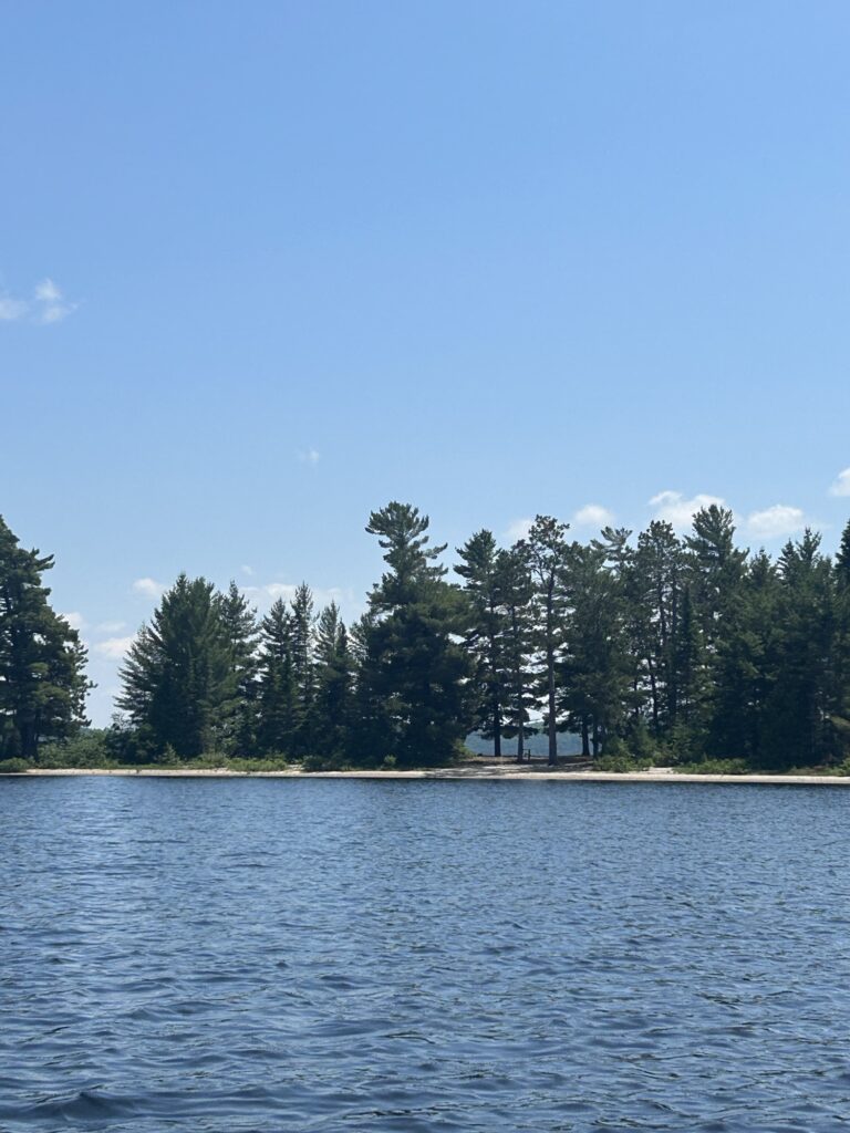
We found the island , we had first spotted after exiting the creek, unoccupied and explored some of it. Obviously well used as a camp site by lots of people. There were the usual things you find at a well worn site: Nails driven into sap bleeding pine trees. Axe hacked trees and stumps of those that had been felled. A crusty fire ring with burnt beer cans and cigarette butts scattered about. Tent rope tied between trees for clothes lines. There were an assortment of old metal grills hanging from nails on one big pine tree. Yes this site had seen a lot of use! A couple of old plastic buckets sat below a fish cleaning station someone had built. Pretty typical really. It was a beautiful location though! Sandy beaches on both sides with shallow water access for watercraft. I could see why it was so popular. But I knew firewood would be scarce at such a location and made a mental note of it.
The island campsite on Lac Sairs.
Gracie and I hung out on the island for a time before trying our luck fishing near it but we had no luck. We could see a group of campers far down the lake on another sandy point. The lower part of the lake was huge and not very inviting for canoeing. I was a little nervous about the return trip across the big part of the lake in the rising wind and waves so we headed back to the creek inlet and fished there while. The older fellows passed us again and headed back up the creek. I thought it strange that they left so quickly after only fishing for an hour or so. Could they have limited out that quickly? Perhaps. It does happen. They had obviously targeted a certain spot and had never moved off it. Interesting! As for me? All I had caught on Lac Sairs was another small pike.
As Gracie and I paddled back up the creek two more boats passed us. Something was definitely happening on Lac Sairs! People were working fairly hard to get boats towed into Lac Charette to access Lac Sairs. Given the rough roads it must indicate good fishing! The bugs were a little annoying but bearable out in the sun. The bugs didn’t seem to be deterring people from coming here. All this was rather perplexing and I began to think about returning to Lac Sairs. But when and how? I could never pound my boat and trailer over those rough roads for a few walleye! And the canoe was rather small for large Lac Sairs. What to do? I decided to mull over it later once I could better concentrate on the subject in the comfort of the truck on the drive back to Camp Sparrow Song. Home base would provide better access to the internet and maps.
Gracie and I fished more on Lac Charette once we exited the creek. I had a fish on that looked like a walleye but it threw the hooks before I could get it to the canoe. Further up the lake there was some fast moving water below a beaver dam that was entering the lake. The waves were bad out on the lake so we fished below the beaver dam in the rushing water. I caught 5 more small pike and they were pretty scrappy in the fast moving inlet. Fun times! But no walleye were caught that afternoon. I left the lake a little frustrated but happy to have caught and released 7 pike. It would have to do!
Below the beaver dam. Denied easy access to what lies beyond.
So that’s a detailed description of the Lac Charette to Lac Sairs probe adventure. I later spent a lot of time considering options for a return trip and how would I do it. A small boat would be ideal. Smaller than my 14’ Alumacraft and with a smaller motor. But time passed and I came no closer to solving the logistics of getting any boat into Lac Sairs. But then I got to thinking about canoe camping there as one final adventure before I leaving Quebec in the fall. Remember my post about the failed hike into Turner Falls? The Forgotten Path post. What if? What if I paddled to Lac Sairs and set up camp near the river? Turner Falls is upstream past a lower set of rapids that can be portaged I had read. I could manage that expedition right? And possibly seek out some walleye while I was there. So the plan began before I even returned from taking my boat home recently. I returned to Quebec last Tuesday after one week home. The weather was promising and moose hunting season hadn’t begun yet. There was still time to make a Lac Sairs expedition happen!
Wednesday morning I got packed quickly and got ready for canoe camping on Lac Sairs. I packed plenty of food and warm clothing. I even found room for my portable fish finder! Talk about priorities! I pulled my ZEC permits Wednesday afternoon and off we went up the “819” bound for Lac Charette once more. Traffic was light but I met a log truck with its huge billowing clouds of dust. Wow! I pulled over till it passed. BTW. They have the right of way.
The “819” is very familiar to me now and I cruise it fairly fast. After the turn at kilometer 38 the next 10 kilometers are washboarded bad! The truck jitters all over the place. So I slow way down. The final stretch to the launch is ok but slow going. Haste makes waste the old saying goes. The truck is the only way out so I protect it from damage. Common sense is beneficial in the back bush country.
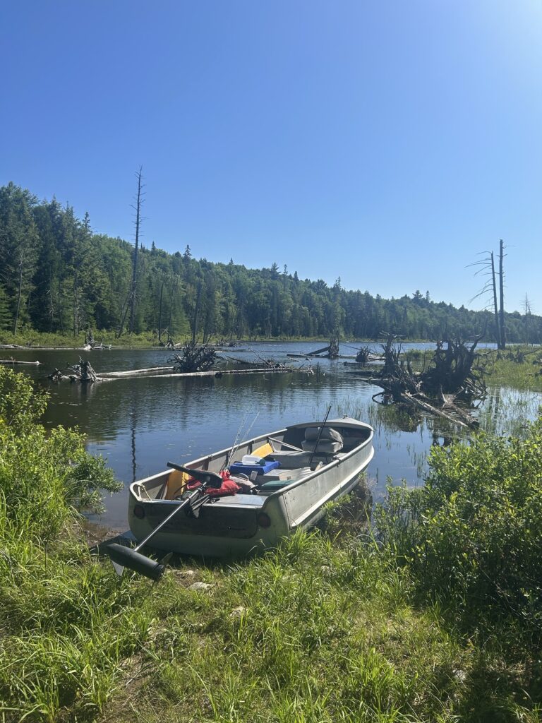
Loaded up at the Lac Charette launch.
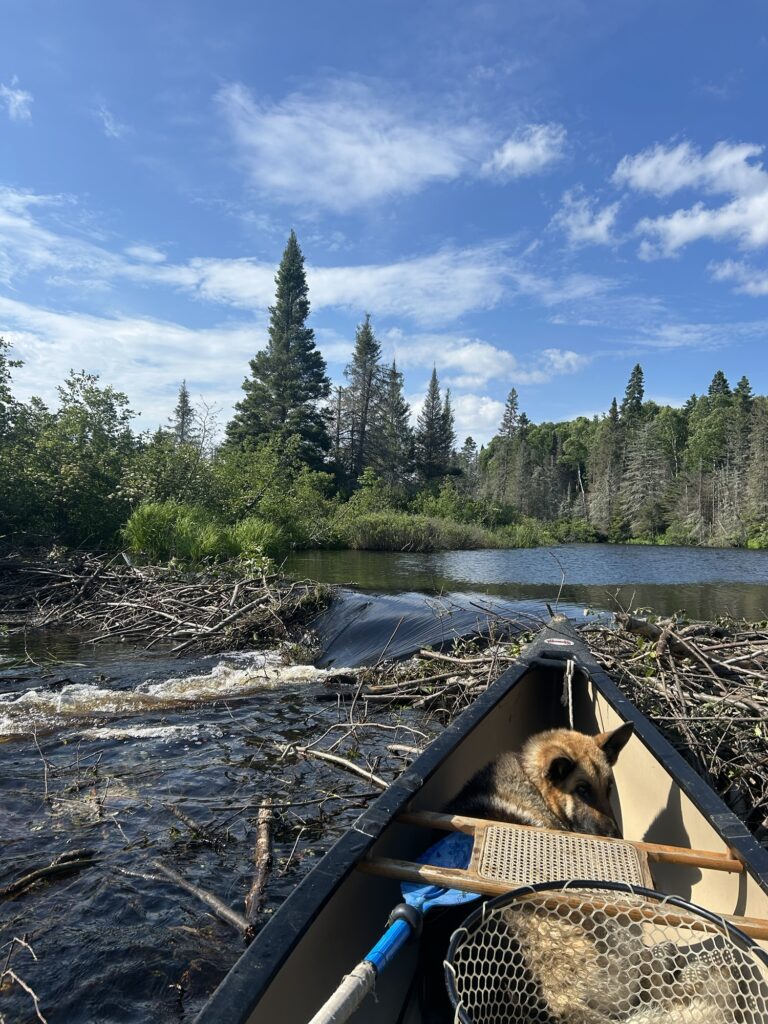
At the launch I quickly unloaded the canoe, carefully packed it, and parked the truck. Off we went across the very calm lake. We were pretty heavy but very stable. This was going to be easy! But I was wrong about that! As we neared the outlet to the lake where the creek started a pair of otters dove off shore and surfaced nearby watching us. Very cool! Things looked rather tricky at the formerly breached beaver dam that we had floated over in late June. Two large piles of sticks lay on either side of the former breach. People had been pulling out the dam over the summer to get their boats through but the beaver were winning now. This was a bit of a dilemma for Gracie and I with our heavily laden canoe.
Beaver dam!
I managed to slide the canoe over the dam with a great deal of effort and some tricky balancing. Gracie never budged so I had her 80 plus pounds to lug also. But we made it! I noticed right away the level of the creek. It was super low and much different than it had been in late June. But it was passable at least, lucky for us. That is until we hit the next beaver dam. It was an old one fortunately and mostly flat but I still had to wrestle the canoe across. Quite the workout! Almost more than I could handle alone! Those damn pesky beaver I thought!
We encountered one more old beaver dam in the creek but managed to just scoot over it. Eventually we reached Lac Sairs and were greeted by a very altered shoreline. The water was rather low. The formerly submerged sand bars and beaches had grown to larger proportions. There was the odor of wet vegetation that had been exposed to the air and sunlight. A very different lake now existed. It was obvious that the water was dropping almost daily.But the lake was still massive at any rate.
There were no big waves so we fast tracked directly to the island we had visited in late June. No one was there so we claimed the campsite and got camp set up. Step one was complete! I found a nice flat spot for the tent.There was a picnic table also that hadn’t been there in late June. I had brought a folding chair which I planned to put to good use.
It was time to explore after a quick search for firewood. Firewood was in short supply after months of people camping on the island. Toilet paper clumps weren’t scarce though. They dotted the shoreline and were all through the woods. It was obvious that a big rain storm had recently scoured the island. A grand flushing of sorts that I was thankful had happened.Human waste is disgusting to camp near. Yuck!🤢
TP island.
I named the island “TP Island” after that. Not to be confused with Teepee. There’s a big difference. I set out cleaning up the campsite by starting a garbage bag. People had disrespected the island I’m sorry to say. I found a bucket with several rotten fish in it with a collection of bones. Pretty gross and I dumped the mess far away from the campsite. Yuck! 🤢
As for firewood? Lucky for me there was old dry driftwood hidden in the brush left by the higher waters of spring. How people had missed it all summer is beyond me but I managed to collect enough of it for the evening fire that I hoped to enjoy. I also found some nice pine resin wood that I cut off an old dry stump. A bonanza on the wood depleted island. I would manage I decided. I also found some hollow birch bark logs that I salvaged for tinder. All was well in the firewood department. But only for one night. Hardwood was difficult to find but I did find some to use for cooking. Provided that I caught a walleye or two!
I got my fishing poles ready and set up the fish finder. My goal was to reach the lower rapids in the Kipawa River. Not too far a paddle from the campsite I soon learned. At the time I couldn’t hear the rapids because of the direction of the wind. We left the campsite beach much lighter with the gear now on shore and paddled to the entrance of the river. It started out slow moving and was very dark. Only about 12’ deep on average. I passed a dry beaver house sitting up on the bank. They were beginning to work on it for winter and had collected some green brush to start their winter feed pile. But if the water didn’t come back up it was going to be rather tough for them. Did they know something? Was this a normal occurrence or unusual drought situation? Quebec had been getting some rainfall but nothing drastic. The beaver might need to make some housing adjustments if the water stayed low.
There was a huge landslide of trees and logs that had slide into the edge of the river. Continued erosion of the sandy banks it appeared from the high waters of spring no doubt. Ice out must be wild here I mused.
Water certainly is a powerful force and it’s evident in the piles of debris and sunken logs that lay under the surface of the river. I watched for sunken “sleepers” that could potentially tip us over. Always a possibility. Sunken logs can be rather creepy at times I find.
I rounded a weedy curve and thought it looked fishy. I tossed a Mepps Aglia and caught a small pike next to shore. Further up a huge lagoon sat below a tall sand bank. Obviously eroded by years of high water. It was eerily unstable looking almost. No place I wanted to climb around that’s for sure. The whole location was spooky for some reason. I had another small pike poke at my lure near the lagoon next to a heavy weed bed but it lost interest.I ended up just below the rapids but due to the low water they were fairly tame. I fished around in sections of them but only caught one more small pike. There were plentiful snags in the rocks and I soon tired of the location. I made a note of the portage trail below the rapids. Thursday’s planned excursion.I floated down to the curve of the lagoon. It was an impressive 30’ deep in spots. Some fish showed on the sonar near bottom but they didn’t bite. I decided to get back to the big lake and try my luck there. The lagoon made me nervous for some unknown reason. I was happier away from it.
The rapids. Turner Falls lies somewhere upstream.
Down where the river enters the lake, I encountered a most unexpected and unusual thing. In line with TP Island a sandbar practically blocks the flow of water! A narrow rift exists that is only about 8” deep and is fast moving. A person could literally walk across the lake here! I named the main section “ The Rift” and quickly realized that good fishing might lay just off a drop off where the big lake widens out more. I tossed a worm covered jig head behind me as the inches deep water changed rapidly to eventually 30’. My line got heavy and tight suddenly. I reeled up and was rewarded with a fighting fish! I soon netted a nicely colored, legal 16” walleye! Dinner was secured! Soon after I had another fish on and it was a fighter! But it was a medium sized pike that I released after a feisty battle. After that the bite died and I fought the wind and small waves in the rift current until I tired of fishing in it. The Rift showed potential and I was glad to have noticed it.
Back at camp I cleaned the walleye and started my fire. Once I had enough coals I lightly battered it and cooked it up. Yummy! Picture perfect as darkness overtook the campsite. Golden, crunchy goodness that only the taste of walleye can deliver. I sat by the fire until I ran out of firewood after feeding Gracie. She enjoyed one small piece of fish that I was too stuffed to eat. One walleye was all we had needed.
Cooking walleye.
And that’s how the day ended. Warm and fed. The tent nearby with my sleeping bag ready to go. No air mattress though. That was hard. Literally. But my sleeping bag is rated for 20 degrees Fahrenheit. I would manage. Loons called and the wind flickered fire danced on the tent wall. My day was complete. I had called home on my satellite phone. All was well! The adventure was well underway and time was passing. But I was still rather irritated at the beaver because of the dams. I felt more connected to the otters I had seen in that moment. Quite a difference for me the lover of all things beaver. But otters? Yes! Fishing and eating fish! Roaming and frolicking a long the lakes and creeks. Carefree and happy not burdened by building dams and industrious tasks. Was I more like the otters in my moment? Yes!
But I still respected the beaver for what they bring to nature. One splashed near the canoe just as I was dozing off. Ok beaver I thought. Now I am irritated again. But it was of little concern. I was the invader of their world actually. What right did I have to be irritated? Perhaps they were irritated at me! 🤣
Sleep came slowly in my new surroundings but not because I am afraid to sleep in the bush. I sleep with two knives and an axe. I’ll come awake ready carve a fillet off anything that invades my personal space. That’s the mindset anyway. I was overexcited I suppose. Over stimulated by the location and the experience. But the calling loons eventually serenaded me off to sleep as they answered each other around the lake. Gracie was lying close by outside the tent. All was well and tomorrow was another day. No rain and no bugs! What more could a camper wish for than this? ✍️
July 17th and lots has been happening here since my last post. I returned to Quebec with the boat on June 20th after a week back home. Zane and I had tried out the new 15hp Honda motor and it’s quite the powerhouse! It trailered up well and there were no incidents fortunately. I launched it that night and went out for walleye but only caught a couple little smallmouth bass that I threw back. But it was a beautiful evening with a spectacular sunset! Catching fish isn’t everything after all.
Wow!
The next day would become very memorable! Gracie and I set out on rather calm water to try for lake trout in a couple locations. After quite a bit of trolling I finally caught a small throwback 17” long. They must be 26” long to keep here now and your limit is one. 25 years ago you could keep two if they were 20” if I remember correctly. We had good luck catching them back then.
I was pretty happy to have caught a lake trout despite the fact that I wasn’t sure which lure to use. It’s no longer legal in Quebec to use the frozen real minnows we used for bait years ago. That gave us an edge I guess. They worked well! I heard a William’s W60 blue and silver spoon was a good choice for lakers here so I planned to buy one or two locally if possible.
Gracie and I headed in for lunch and a break before considering our move for the evening walleye fishing. It was looking like rain and a possible storm. I got to talking to some fellows in a rented cabin down by the outpost docks. They had two big boats for four guys. They were planning on trailing their boats to a section of the lake where they had fished in the past the next day. So they were sitting around having beers and talking. Nice people!
It started sprinkling but I decided to put my rain suit on and head out anyway. The lake was rolling pretty good and there were some big waves to travel as we headed to the “Beauvin Narrows”. I had a spot in mind there to try. A point that jutted out into the narrows. I had seen a boat there on Friday night.
There were no other boats around as I attempted to anchor the boat in 20’ of water on the point. I couldn’t get my anchors to grab. I was forced to hunker down behind an island nearby where I could hide from the waves. I had one bite but that was it. The wind and waves subsided some so I made a second attempt at anchoring on the point. I was successful that time! The rain had stopped at this point and I was happy about that!
Almost immediately after dropping my bait float and leech combo, I had a bite that I missed. But soon after I caught a beautiful 17” walleye! A fighter but I managed to net it. Shortly after that while tossing a jig with a worm I caught a second 17” walleye! This was great and I felt pretty fortunate! The bite suddenly stopped though as the wind picked up again.
A gust suddenly lifted my new hat off my head and I tried to hook it with a jig. No luck! I was forced to lift anchor and give chase after my fast moving hat! I retrieved my hat and suddenly noticed the black sky and fast moving clouds. Soon after I felt stinging rain drops and decided that I needed to get back to the dock! But I was suddenly hit with wind and a heavy downpour. I could barely see to steer the boat and the wind whipped up huge waves. Thunder and lightning added to the moment although it was off in the distance.
And so began a wild ride back from the narrows! I was soon soaked despite my quality Frog Toggs rain suit. But this was no ordinary rain storm! This was much more! I eventually reached the dock and one of the cabin renters came down to help me carry my gear to my campsite. Very nice of the fellow named Todd to do that! I was happy though as I had two nice walleye to show for my effort! I cleaned them in the rain and froze one.The other I kept out for a Sunday fish fry.
Sunday’s fishing was uneventful and I had no luck. But I enjoyed a wonderful fish fry! Yum! My neighbor Rick invited me to go in his boat up to a place in the lake called Lindros. Retired hockey player Eric Lindros has a fishing camp there. We would also fish a location called Sunnyside. It once was farmland they tell me. Flooded when the dam was built and the water rose to bury the buildings. Pretty wild stuff to consider!
Monday’s trip to Sunnyside was rather uneventful. We couldn’t find the fish on Rick’s high profile fish finders. He has all his favorite locations marked and numbered. It’s rather impressive! Rick managed to catch two small throwback walleye while I caught nothing. Any walleye under 14.5” and over 20.75” must be thrown back . It’s known as the “slot” size. Important to obey as the fines are steep for violating the rules. Anyway we tried and I now was familiar with Sunnyside and Lindros. I decided not to fish Monday night and take a break.
The next day I headed out early and tried out a new spot for walleye. I only got one that was right at 14.5” and I threw it back hoping for a larger one. A move that I would later regret but I was overconfident at that moment. I did not catch anymore after that. That afternoon I trolled for lake trout on an upper section of the lake. I was totally unsuccessful but enjoyed the nice sunny weather! Fishing was proving difficult on the big lake I was learning. Other people were struggling as well to catch walleye and a fellow named Randy said they had lockjaw! He’s a veteran fisherman here and when he’s not catching most likely others aren’t either. It was time for a new strategy!
A sunken snowmobile at an abandoned Squabe camp. ( local name for squatter)
I pulled the boat from the lake Tuesday night and removed the motor and trolling gear. My new friend Bob, his BIL Rick, and I were going to use my boat at a nearby remote lake to try for speckled trout. It was once a hotspot for them. We would use Rick’s electric trolling motor to move around the lake. The day was sunny and calm fortunately. The setup worked well but the trout were sparse. Bob and I both got 13” speckled trout. Bob gave me his. It was a fun outing listening to Rick and Bob share stories about the old days fishing there making large catches. The Canadian government no longer stocks speckled trout in the lake unfortunately. But I learned a new place and a new fishing technique. And the trout was yummy! I ate the smaller of the two.
Headed out for trout.
The next day Bob, BIL Rick, neighbor Rick, and I took two boats to fish nearby Temiscaming Lake. We were headed to a spot called the “volcano”. The tree pollen was everywhere on the surface just like in Lac Kipawa. Some said it was affecting the fishing. Rick and I were in his big boat while Bob and the other Rick were in his. I catch nothing yet again and Rick managed to bag two throwback walleye in our boat. Bob got a feeder and Rick got a really nice 23.5” walleye. Another tough day of fishing for me. But another lake learned.
Pollen in the water of Temiscaming Lake.
Later that evening I drove back to the ZEC Restigo to scout out a new lake for possible fishing. The mosquitoes were horrible! But I reached the lake only to find a camp there. And a questionable bridge to cross as well. I decided to pass on the lake. I saw a cow moose on the way out though! Very cool!
Saturday morning I pulled my ZEC Restigo permit to paddle and fish down the De Jardins River. There was an interesting lake on the map that it flowed through. I packed a lunch and headed out despite the cloudy conditions. The river was running rather strongly and I was going with the current. The bush came right down and actually hung into the water. Tag alders mostly being a water tolerant species. I soon reached a wide swampy area where the Bleu River dumped in. I explored a little of it before moving downstream. There were moose stands on the edges of the bush, a salt lick, and even a camp up on an esker. Signs of people who hunted in the fall here. The river wound through an even larger wetland that became huge. There was no place to get out for a break unless a person wanted to stand on old rotten beaver huts. This was a wild place! Almost spooky in some strange way. I reached the lake I sought but it was nothing but a shallow, weedy place so I turned back. The wind and current made paddling difficult for me. I was disappointed and almost angry with myself for choosing this location. But after a moment I pulled myself together to be grateful for a location for what is actually contains. A thriving wetland that moose must love. Thickly forested bush on the distant ridges. No other people in sight. Just me and Gracie far from camp in a most remote setting. There were ducks and distant singing birds when the wind died down at times. By the time I had reached the point where the Bleu River merged with the De Jardins, I was ready to continue my adventure. I tackled the current up the Bleu, past the camp, and headed towards the sound of a distant set of rapids or waterfall. The river narrowed and the beaver were trying to dam it up. Unsuccessfully at the moment though.
The marshy lake.
Eventually I reached the rapids and could paddle no further. There was no way to portage around either as the bush was super thick. I wedged the canoe into the brush and started fishing. Maybe trout lived here! I soon had a strike but it was a small slinky pike. I kept tossing my lure and managed to catch more small pike. There was a calm eddy right on the edge of the rapids and it looked fishy. I managed to get my lure into it and was rewarded with a strike immediately! The fish turned out to be a 15” walleye! A keeper!
I stayed in the rapids for two hours or so. I caught 6 small pike and the walleye. I was eaten alive by biting black flies and a few deer flies. Mosquitoes also. But I was totally content. I had been in the canoe for hour as there was no good place to land. It was that thick there! I was a little wet from rain as well but didn’t care to put all the rain suit on. I leave the rapids and paddled back to the landing where the truck was parked. I was very tired and super sore. In the rapids by the launch I caught one more tiny pike that I mortally hooked in the gills. I quit fishing then. It was a memorable day and I sadly acknowledged that I probably would never paddle there again.It was just too rugged and there were many new places left to explore.
I ate my 15” walleye that night. I had worked hard to get it! I made a plan for the following day. A new lake and a new adventure. My sprit energy was refreshed and my spirit batteries were recharged. What had I learned? Many things actually. I had learned that this rugged area challenges a person. It is beautiful but harsh at times. Fish just don’t jump into the boat. You must work for them. And I ask myself if I am still tough enough for this sort of thing? I enter the bush full of energy and leave exhausted. Sometimes feeling down by my poor success at catching fish. But perhaps I put too much emphasis on my success in fishing. Am I missing something by doing that? What I am learning is to take the time to be grateful for this experience. This grand experiment that I have undertaken. The people and the places that make it grand. I have learned to catch my breath and smell the scent of sun soaked forest and tan colored water rushing over the rocks. Fish has never tasted so good either. I am strong and capable of making this happen. Someday I may not be so fortunate. Wanting more is not always the best approach. Just being here should be enough. But I do love the thrill of a striking fish tightening my line as it rushes away and the battle begins. That is addictive and thrilling. It is a complex spin I suppose. I have learned to enjoy the complexities of this spins and to let them give me cause to reflect.
So what have I learned? All this and more. I can handle solitude and being far back in the bush where I must depend on myself to get out. I have learned that Gracie the dog is a first rate companion to me and someone to talk to and listen to my profane outbursts at times. She doesn’t even pay much attention really. Selective hearing dog style. I can snap like a brittle twig sometimes. The bugs,the wind, a tangled fishing line, or snagged lure can push me to the limit. But in the end the scenery will quiet me and remind me of why I am here. Perhaps I am learning to slow down a little? Doubting that as I plan my next adventure chugging maple syrup infused coffee each morning. Time will slow my body down.Of this I am most certain but I will resist giving into it. Here I am free to run wild in wild country. It is enough!
Mid January finds with a small amount of snow on the ground but nothing major. 6”-8” of powder snow isn’t much for this time of year really. Last year on this very day we had a snow storm that dropped several inches on us after a warm spell had left us with mostly bare ground. I was recovering from my artery incident then and wasn’t pushing myself too hard. Walking mostly but we managed a few other tasks around the cabin. It was a new chapter for me then.
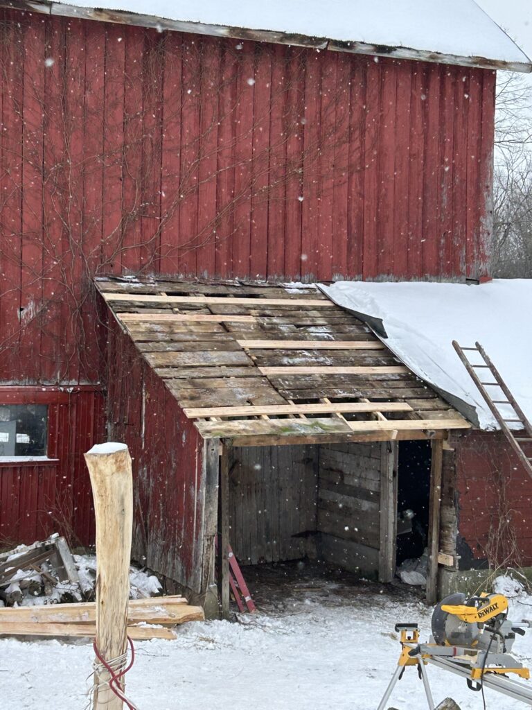
I have been balancing my time between the valley and the Adirondacks since the end of fall to now as I mentioned recently in my last post. The biggest news recently is that with the help of the Amish carpenters we finally finished the siding on the cabin last week. Some soffit work remains but the weatherbeaten tarpaper is now all covered. Zane and I had sawn plenty of siding fortunately so there was no danger running out. We also removed some old rusty roofing from my Uncles barn up the road at the property where I had my first house in 1983. We repaired the lean to roofing boards and some structural damage before adding 4 sheets of new metal. The old metal matches some that my Dad had repurposed from the old garage that used to be here before the 2012 house fire. He used it on the sugar house here and I may need it also for the cabin. I started out just wanting some old metal to put on the wall behind the new wood stove in the cabin above the Drury brick hearth. But then I decided that I want old metal on the ceiling in the new addition of the cabin. It remains to be seen if we will have enough to do all our work. It’s stashed outside and needs a very thorough cleaning. Maybe I will flip it upside down and show the underside which has no rust. The design on the metal is what makes it special. A wave type pattern repeats itself a long the length of the 2’ wide siding. It’s very unique! We had a couple of rather cold days last week while doing our outdoor work but we soldiered through despite!
The repairs after the removal of the old roofing
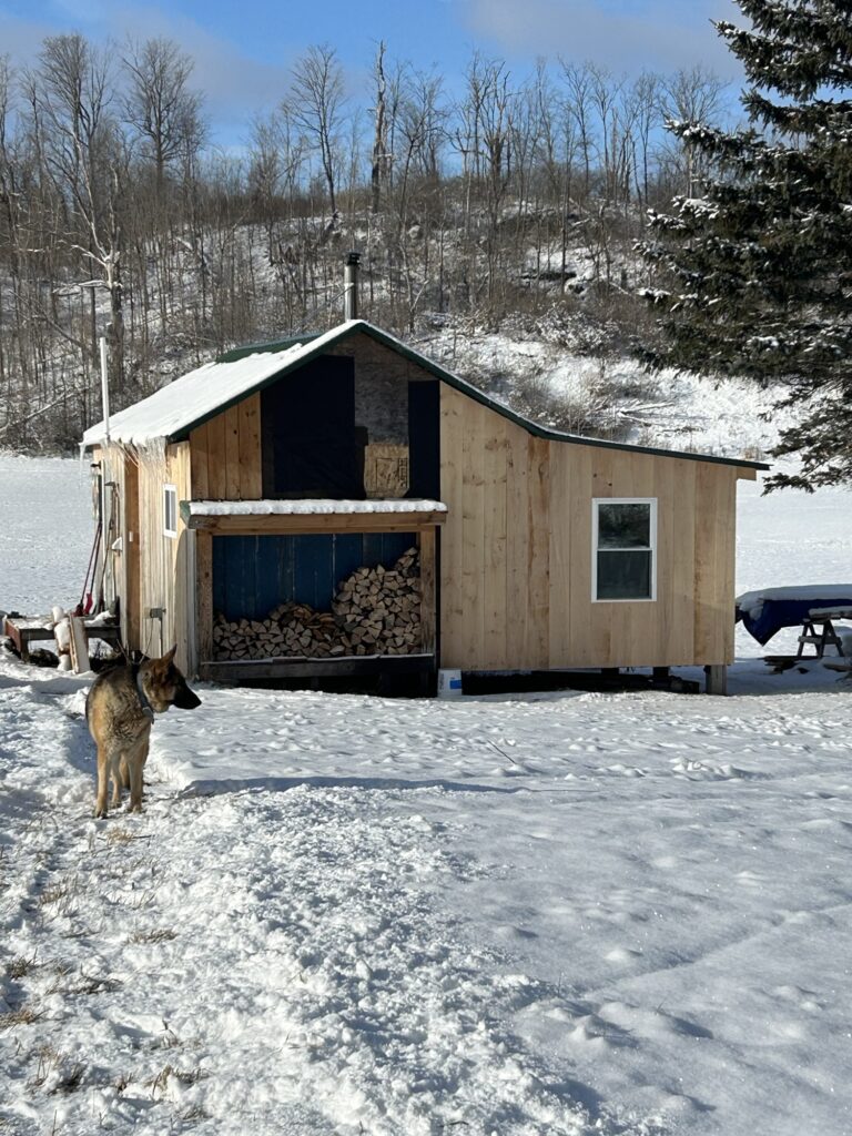
By last Thursday I decided that I needed a day to just catch up on a few things around the cabin. The carpenters had finished their work here that they had time for by Wednesday afternoon. So I hauled some firewood and stocked up the cabin woodshed. Keeping firewood stocked for the cabin keeps me rather busy actually especially on cold days like we had last week. It’s noteworthy that I had just installed a ventilation fan in the loft floor of the cabin and ducted it into the new addition. With more insulation in place it has been heating well since. The loft is much cooler as a result. Before it was way too hot up there most nights while the back portion of the cabin stayed rather cool. I think things will balance out well now. As for the firewood, I have been hauling it down from the old granary up behind the barn where it was stored last spring. Super dry hardwood slab wood from the sawmill project at my friend Gregger’s last spring. It just needs a bit of splitting here and there. The mixed cherry and yellow birch make a super hot fire. Before too long we will need to cut and haul in some dry red elm that’s burn ready. Our current supply of firewood won’t last until spring.
The siding progresses.
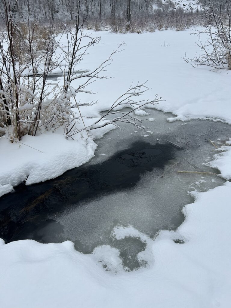
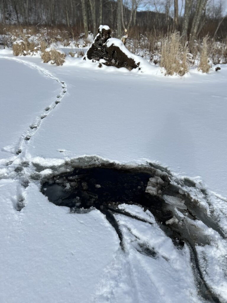
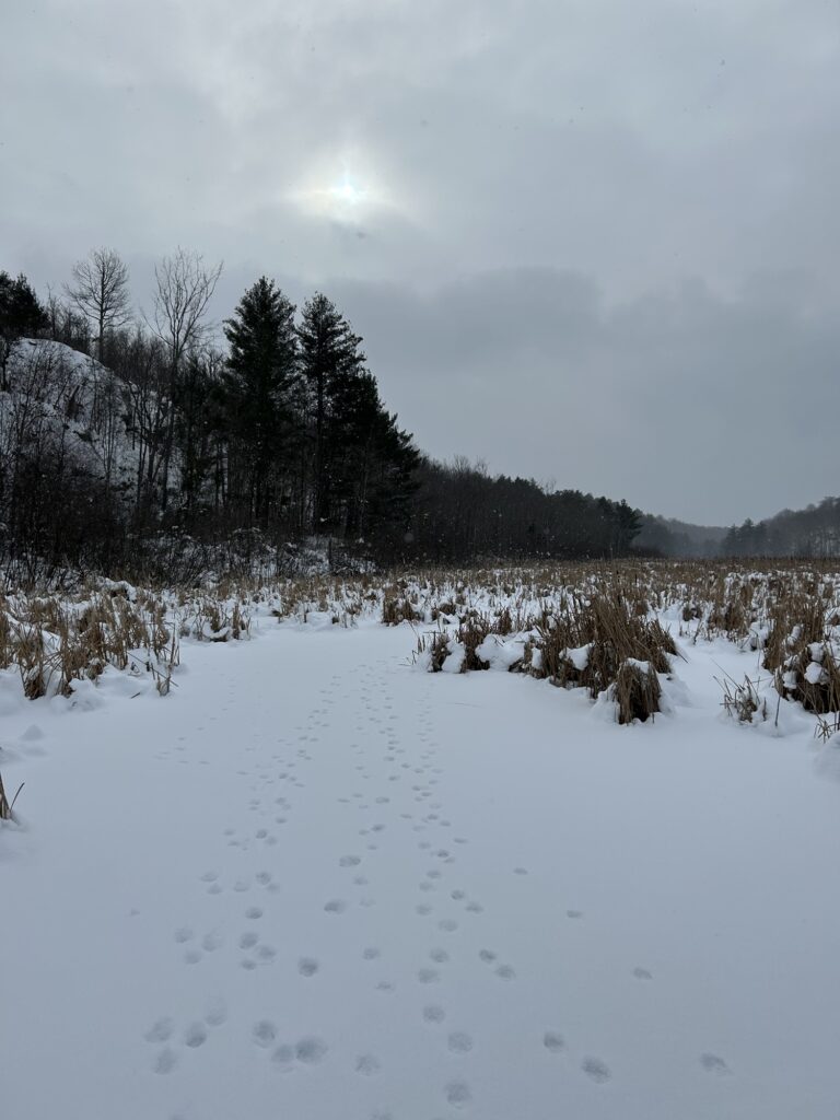
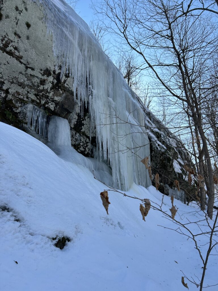
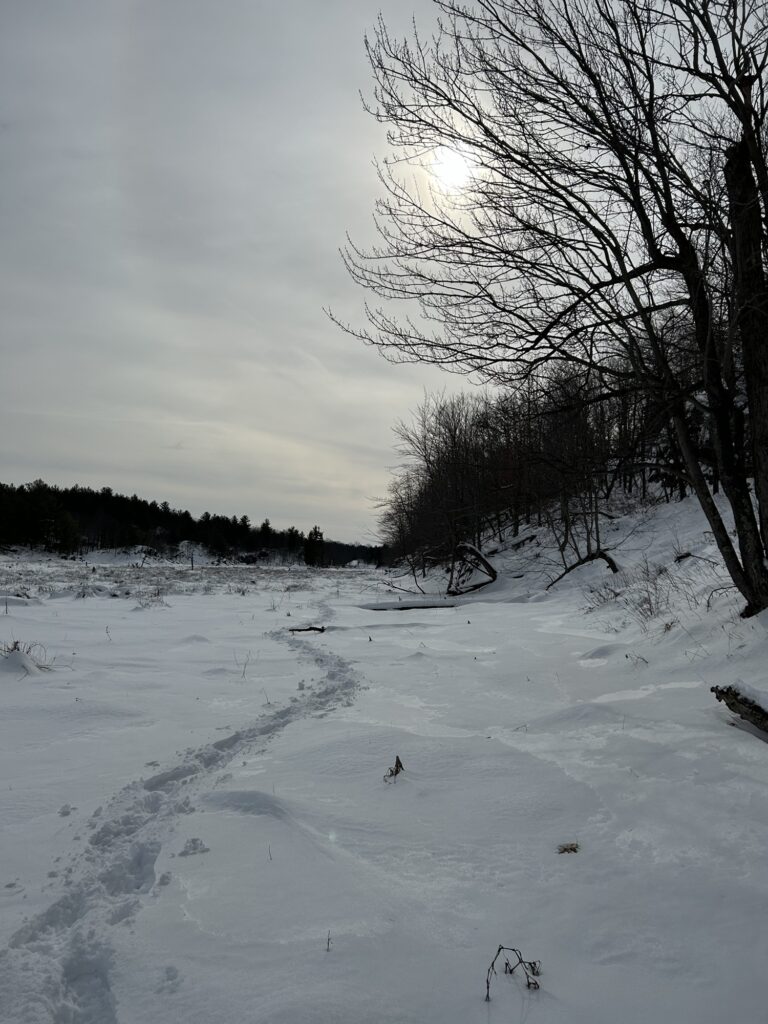
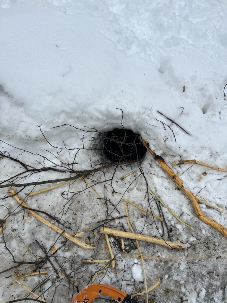
By Thursday afternoon I was ready for an outdoor outing so I decided to snowshoe down Beaver Creek if the ice was ok. There barely enough snow to need snowshoes but I wore them anyway.Upon reaching the edge of the marsh where the grass is thick, I quickly realized that the ice wasn’t all that great. I struggled out through the bogs breaking through in several shallow spots before reaching the bare open sections. But even here the ice was very thin and weak! It wasn’t looking good but I didn’t want to backtrack across the crappy bog part so I pressed on. Slowly and cautiously, I might add! The ice was fickle and unpredictable. Some spots were ok but my tapping beaver sticks would detect hollow sounding spots below the snow covered surface. Death traps I call them. I managed to skirt several tricky spots and reached a deeper wider section of the main channel. After one rather close call I chose a shortcut on a smaller side channel that held me up rather well. I soon reached the area we call “The Deep Hole”. It seemed like decent ice but was slushy on top. A sure sign of thin ice being pushed down by the weight of the snow. I became even more cautious and my forward progress became even slower. I noticed an active beaver lodge and was happy to see them occupying the area. They come and go from this spot on occasion but continue to occupy it mostly. I knew that I could never hope to get across the main beaver dam that spans the creek here. It’s a challenge at times even with much better ice. I approached the dam and laughed when the dog almost broke through where she was walking next to it. I was trying to get close enough to what we call the “Big Cliff” to get photos of some large icicles hanging from a section of it. Without warning I suddenly plunged through the ice with both snowshoes! There was no cracking first or anything suspicious! Just a death trap breakthrough! I was held up by beaver stick walking sticks fortunately and for a second was expecting the shock of cold water filling my boots! But I lunged up onto my knees and somehow avoided getting wet! My nylon hiking pants were so tight around my boots that no water got in! My knees got a little wet but that was nothing. Snow on ice is the great insulator and the death traps are invisible from above. Even the tapping and probing of the beaver sticks fails me at times. Just one of my many plunges over the years I suppose.
The plunge hole!
At this point I lost my desire to ice walk any further! I cautiously and nervously backtracked my way to a channel that got me safely ashore in the stand of white cedars known as “ The Cedars”. This tiny grove has been here my entire life. Never really getting any larger or much smaller. Sometimes the beaver cut a few and years ago we cut out some big dead ones for salvage. The Cedars seems ageless although I didn’t see any of the tamaracks that once lived alongside the cedars. Perhaps they are all gone. The cedars contains a couple of boggy spring holes that never freeze. I used to trap here as a young boy for raccoon. In winter I trapped ermine under the shelter of the cedars in small cubby sets. I used wax paper to keep my traps from freezing. I once caught a red fox here also. My ermine traps were empty most of the time but I didn’t care. I became familiar with the area and loved its remote feeling of winter beauty out of sight of the road and the farm buildings. I was destined to desire to explore this area and all that lay beyond it was I grew a bit older. The marsh was my classroom and I was an interested student who showed up frequently. And the spirit of the Icewalker was forged here. Not of molten metal but of ice and snow. Adversity would thrill me here. Wet feet and cold hands. Frosty cheeks and nose at times. Those were cold winters. Some nights my Father would not let me run my small trap line because of the cold and approaching darkness. But I would return soon and resume my frosty activities. There are many memories here in the marsh of the big gorge. Perhaps that’s why I return each winter.
After a rest and the reminiscing, I tackled the cut up the side of steep ravine that would take me towards the Homestead cabin where the warm wood stove awaited. I stopped at one point and gazed back at the marsh. I was disappointed that the ice had not been better for traveling. And I pondered several things then. How many times had I stood in this exact spot over the years? How different the winters are now. How much older I had become. And how the draw to run the ice and call myself the Icewalker had never diminished. How long would I try? How many winters would gift me the opportunity? Such thoughts became too much then so I chose something far different to break the serious moment. I spoke with my best Arnold Schwarzenegger imitation downhill towards the marsh: “I’ll Be Back!”. But no one heard me but the dog and a few disinterested winter birds. But that was fine. I know that I will be back if good fortune and good health continue to favor me. And I will play the game of staying on top of the ice as I move forward to explore the further reaches of the gorge of the big creek called Beaver. I have no fear there. Just respect for this beautiful and enchanting place. I have traveled the ice here more times than I can remember now. What adventures I have had! I will be watching and waiting for signs of better ice. Then I will set out once again! And not forgetting the Icewalker’s motto: The distance in must be traveled out!” It is enough! ✍️
It’s been a busy week since my last post and Zane returns to college tomorrow after his long Xmas break.It will be strange with him gone as he’s been with me a lot since the angina/artery situation. My health is good and I have the clearance to exercise more now. Things are going well and I feel great! The snow storms of last weekend dumped a fair amount of dry snow and the high winds made drifts.It’s settled quite a bit now given the unfrozen ground underneath but we had close to 16” at one point. Monday found me plowing out the driveway and road up to the warehouse. Tuesday started well but the tractor quit right in the road and had to be towed into the barnyard with the 4wd truck. It appears to have a frozen fuel system given the ice in the fuel filter cup. The temperatures were dropping so after a feeble attempt to restart the tractor I decided to wait until it warms up later this week. We were in need of some burn ready firewood so Zane broke a trail up to the warehouse landing with the side by side. I had a decent sized red elm tree stashed there for a “just in case” moment. Good thing! We cut up enough to refill the cabin’s outside woodshed. Zane split the larger blocks by hand. Luckily red elm splits easily except where there are knots. We were back on track and ready for the cold snap that was coming!
Wallowing for wood.
Tuesday we decided to continue banking the cabin with snow as temperatures continued to drop. We used some old hay bales dumped on the outer lawn last September as infill for several high open spots along the back wall of the cabin. Some old OSB had to be cut to fit on the front of the cabin as did some pieces of foil faced foam under the entrance deck. We then shoveled large amounts of fresh powder snow against all four walls. The difference inside has been noticeable in the much warmer floors. It had been my plan all along but we had needed the snow to accomplish it.
Banking next to the Chop Shop.
We had planned some inside work for the remainder of the day but we both wanted to stay outside so we took the side by side up to the Rastley Road to clear out storm dropped limbs we had found while breaking out our trails. We ended up with some beautifully dry, burn ready, red elm to top off the woodshed again plus some ok dead maple. It was a rather cold job but we found it rewarding and fun. We were burning through quite a bit of wood so it was nice to get ahead with some extra. Settling in for the night was always a pleasure and I cooked us up some really hearty meals each night. Post dinner evenings were spent plopped down in the loft relaxing. I watch Netflix and Zane plays his new favorite Xbox game. The wood stove turns the loft overly warm sometimes but I still have to stoke it when going to bed each night. I have been using bigger chunks I call “night blocks” with good success. They keep coals until early morning when I get up for a minute and refuel it. I never fill it as it’s just too much heat! At some point we need to install the newer much smaller one.
Clearing out the Rastley Road. The interstate of sap haul roads.
Thursday was an errand type day getting groceries etc. and getting caught up with all types of small details.We built a custom made shotgun holder with old barn wood and tenon pegs. Friday morning was spent doing some miscellaneous work around the inside of the cabin. Some precut and whitewashed lumber needed to be installed in the back section of the loft where the storage area jumps up 15”. We also did some decorating and made some neat hanger hooks out of some unique pieces left over from cutting firewood. I made a custom beaver stick bird feeder support and hung an old repurposed acorn bird feeder from it. No birds yet though. Zane built a nice hemlock door to cover the recessed electrical panel and the poly sheeting that had covered it for months was finally removed. We are gaining! I met with my cardiologist late Friday and got my clean bill of health!
Waiting for the birds!
The temperatures dropped significantly by Saturday morning and I decided that the work could wait for once. Zane messed around with his old chainsaw he had bought and cut up a little wood out back. Sometime around noon we put on our snowshoes and headed out behind the barn to get a trek underway. It wasn’t too bad breaking trails until we got into the wind driven drifts around the tall grass, berry bushes, and brush. We took the old access road down to the section of swamp we call “up the creek”. We own a couple sections of mostly wetlands there although there is some low lying pasture land that I partially cleared a few years back. The invasive wild honeysuckles are bad along the banks of the marsh. That makes for very tough access. I found a way out onto the ice above an old abandoned beaver dam that had been active last winter. This section of Beaver Creek is typically shallower so I decided it was a safer option for our first attempt at ice walking this winter. I guessed the ice at about 3”after tapping with my walking sticks. The heavy snow had forced the water to the surface and the cold temperatures had made some decent “snow ice”. Not the good black ice I prefer but it would have to do as traveling the shoreline through the thick invasive brush was not a good idea.
Headed to the cattails.
It was immediately apparent that there were numerous hidden “traps” in the marsh! Snow covered bogs were not frozen in and had to avoided as did the heavy sections of cattails. We stuck to the more open sections and soon realized that some wandering coyotes had done the same thing sometime since the most recent snowfall. So we followed their winding path further up the creek. Zane was not liking the tricky bog and cattail spots so when we reached another abandoned beaver dam with better ice we crossed several hundred yards of ice to safely reach the far shore.
Safely across.
We both had dry feet still and decided not to push our luck. Not to mention our decision to snowshoe back over the higher ground of the forest would be more strenuous then walking the flat surface of the ice. I was beginning to feel the first signs of fatigue and had to rest occasionally. I did take a few minutes to go out of our way to show Zane the Big Spring. My Dad showed it to me years ago. It never freezes as the underground aquifers flow to the surface of the marsh. These springs aren’t uncommon on the banks of Beaver Creek. I know of quite a few along it’s miles of shorelines. Always a place to avoid when out on the ice close to them.
The Big Spring.
We continued our trek after leaving the Big Spring and I was beginning to get tired of the deeper snow of the ridges. We pressed on though and I could eventually see our Long Meadow in the distance. We were getting close to home. As we ventured across the Long Meadow Zane ran ahead and went to the warehouse to get the side by side. I didn’t ask him too but I guess he was worried that I was pushing myself too hard. I was rather happy to climb in though and ride the short distance back to the cabin where I made us a nice meal of fried walleye with beans. I used canola oil but eating fried food can only happen on special occasions now. High cholesterol is bad bunga!
The home stretch.
It had been a decent first Icewalk of the winter! Granted we had traveled more dry land then ice overall. Given the mild winter until recently just having some safe ice was a great opportunity!We had not seen as much wildlife sign as I had expected. No beaver or otter sign. No weasel or mink sign. No grouse anywhere in the forest. Just deer,coyote, and squirrel tracks. One lone porcupine munching bark up in a white pine. Strangely enough there were few winter birds either. The land seemed barren and lifeless although I knew better. Life is being lived below the ice for some. The muskrats especially. We had spotted their domed houses scattered around the marsh so we know they should be there. A couple of ravens put in a short appearance before disappearing over the high ridge line above us. Recently not too far from where we were trekking there were two mature bald eagles next to the road. I believe there was a discarded deer carcass nearby as I had seen another awhile back. If we desire to interact and see more of nature’s winter residents then we will need to go afield more frequently. I will soon brave the ice of the lower sections of Beaver Creek. But not just yet. It’s a tricky piece of real estate and the upcoming warm spell later this coming week may refine it into a safer destination. The big creek is fickle and best respected. I have written of its charms in my “Tales of an Icewalker” posts. It’s beautiful always and can be dangerous at times. We will see what the coming weeks bring. There’s still time to venture forth into my winter playground. But I must first condition myself for the adventure!✍️
I recently wrote about a snowshoe adventure into a new location on Sunday February 5th. The very next day I went on another snowshoe trek had been planned in advance. It was a collaboration type outing I had arranged with Patrick Bourcy several days prior. You may recognize him as the creator and energy behind the Facebook group Just Go Outside. We get together on occasion for treks where we catch up,brainstorm ideas, and basically enjoy some quality outdoor time as friends. We are a good match for outings as we enjoy challenging ourselves! We arranged for a meeting time and the weather looked favorable for a good adventure!
Headed down Beaver Creek.
The plan was pretty basic for our day of fun. I had recommended that we snowshoe down the Beaver Creek gorge and visit the icefalls there. Given the variations in the weather this winter I hoped they would be better then last February. The ice falls never really formed that well in 2022. We had about a 1.5 mile trip in to reach them and given the limited snow on the surface of the wetlands I felt it would be fast traveling. I teased Patrick about becoming an Icewalker if he passed all the tests along the way. It started out as a joke that became something more by days end. We headed down across the marsh under a mostly sunny sky with temperatures rising steadily that morning.It was shaping up to be a great day! The dogs Gracie and Stella were eager to get going as they tore off ahead of us.
We reach the section known as “The Wide Channel”.
Conditions were pretty stable on the ice for the most part but there were several places where we broke through as we traveled over boggy sections that were covered with snow. Patrick was the first to break through but he didn’t get wet. He was right behind me when it happened which was strange because I hadn’t broken through at all! The trek took us past several active beaver colonies with low dams that crossed the span of the gorge. One has been there for many years off and on. The area just below it is a tricky place to cross as it’s boggy surface never freezes well. We both broke through several times but avoided getting wet as it’s quite shallow. The creek channel here is narrow and best avoided. I never trust traveling on it. There was an abundance of deer and coyote sign all over the wetlands but there was little other signs of life except for a few ravens. Our snowshoes on the crusty snow and ice generate a lot of noise anyway. Stealth is just about impossible. We soon reached the “Peninsula”. A steep rocky point of land that juts out into the marsh. We were close to the first set of icefalls!
The Western icefalls.
Things were getting exciting as we got our first real look at the Western icefalls. We got quite near them and snapped a few photos before heading back to the thick ice of the “Wide Channel”. The creek here resembles a river for a short distance and the water is over 10 feet deep . I mentioned to Patrick that a smart Icewalker never remains on the channel immediately after the Wide Channel. It’s a tricky piece of ice real estate that never freezes well because of current,old beaver dams, and curves in the channel. I learned this the hard way years ago on a cold December day of -10 degrees Fahrenheit when I fell through almost up to my neck! I believe that I have mentioned it on this page previously. I wasn’t such a savvy Icewalker that particular day! We detoured on a direct route that took us directly to the first set of Eastern icefalls. Patrick was amazed! As was I! I never tire of this place since they are never the same from one year to the next.
The Eastern icefalls.
We climbed around the icefalls and even managed to get up in behind one small section. It’s an icy playground to enjoy and Patrick was thrilled to be there! We worked our way down to the next set and they just kept getting better!
Up under the ledge.Getting a video set up.Clawing upward.Happy aspiring Icewalker!Stella climbed everywhere with me!
We played for quite awhile and took a lot of photos before heading out. As we left I gazed back upon the spot where a group of us had a picnic in the winter of 2021. I felt a twinge of sadness as one of our group that day passed on in 2022. But I pushed the sadness away as I remembered that happy afternoon of friendship and food. Patrick and I continued down the gorge on the ice of a much wider and open portion of the wetland. The ice was very stable here and we moved quickly with a slightly chilly breeze at our backs. I had decided that since the weather was so beautiful that we would leave the gorge and make our way up to the top of the Eastern rim where there were things that I wanted to show Patrick. We were still full of energy and had plenty of daylight left. It proved a bit more difficult snowshoeing through the deeper snow of forest ravine that led us upwards rather abruptly. We followed an old deer trail since it took the shortest and easiest route. There’s an impressive circular sinkhole about halfway up that I have always believed was created by surface water that found its way into an underground passage. Totally dry these days but very round almost as if a whirlpool had spun its banks into a perfect circle.The outlet of the swamp above disappears underground below the dam near this location.There must be an underground passage for the flow which reappears on the surface far below before entering Beaver Creek.I have always believed that there’s a connection to my theory of the sinkhole which would almost certainly be above it based on the adjacent solid rock formations. I suppose we will never know.
Gracie below the old dam that makes the shallow lake of the Black Ash Swamp.
We took a short break enjoying the sun at the start of the Black Ash Swamp.You may remember my accounts of the Black Ash Swamp as they have been part of other posts on this page. It was wonderful sitting in that warm February sun! I felt totally alive,thrilled, and vigorous in that now moment. We had to make a decision at this point of our adventure. Head out towards the vehicles or journey further down the top of the gorge. I knew of a large ledge and several beaver ponds that I hadn’t visited in years so I suggested that we trek down to them. It was tough going in the deeper snow breaking trail but we were still feeling pretty strong and capable. Besides I was excited to finally be so close to an area that I hadn’t seen in awhile. Enter a new phrase into my stories: “The Icewalker’s folly”. The tiny voice of reason in the back of my mind tried to get an audience but was drowned out by the noisy synapses of excitement and love of exploration! Thus the phrase would later take on significance. We picked our way through a forest that had once been very familiar to me when beaver trapping here years ago. We sidetracked a little to reach an opening in the forest canopy that I spotted from the small valley we were traveling along. It turned out to be a mostly abandoned beaver pond. One that I could barely remember and looking very different with the trees gone these days.
The formerly forested beaver pond.
Our trek continued onward towards what I referred to as the “T” pond given its shape. I remembered it very differently as well when we arrived there. Gone were the trees here as well. They had been flooded, died, and then fell into the depths of the pond. We took advantage of all the pond ice we could since the snow was mostly gone on the surface. Much like it had been down on the ice of the gorge. I was beginning to feel a little fatigue and asked Patrick if he felt like pressing on. I told him it wasn’t much further and I sincerely believed that was true! I took us out to the rim of the gorge and we got some beautiful photos there! It was tough going though with drop offs, deep snow, and thick brush. We finally reached a small summit where I spotted the final beaver pond that we would need to cross. Our final destination was just across a steep ravine below us. I call it Sumac Mountain. There’s a wonderful cliff there to take photos.We were so close! But I was suddenly watching the ever lowering sun and realizing the distance we had to travel out. Patrick mentioned it as well so I listened to the tiny voice of reason when it said: Don’t be stupid Icewalker! It’s time to go back!
Above the gorge.
Our trip back became rather arduous as I continued to break trail back towards a place where we could intersect with our broken trail. I stopped for breaks more frequently but was still feeling pretty good. We finally reached the Black Ash Swamp. That location where we once had considered heading back! Crossing it was the best way out I decided. After that we would cross another beaver pond and head down a gap in the rim to reach the Beaver Creek ice for the remainder of the trek.
Messing around!
The surface of the Black Ash Swamp was a crusty, cratered moonscape of snow. The sun continued to sink lower and I knew that if we kept up our pace we could reach the vehicles before dark. I was quickly losing energy and I began considering waking up the inner zombie. I goofed around instead making a cool shadow video and taking photos. It was scenically beautiful though and that moment wasn’t lost to me or Patrick either. It was that place in time where evening is approaching and you realize that you wouldn’t want to be there all night. I was packed for winter survival but wouldn’t enjoy a night out!
The Black Ash Swamp.
We soldiered on and eventually reached the beaver pond that would bring us to the rim gap where we would descend. There wasn’t as much ice as I hoped and we foundered through some heavy deep snow. The gap was rugged and challenging as well but we finally reached the big creek ice. From there it was pretty straightforward and just required us to keep pushing. I never really needed to wake the inner zombie although I came close a couple times! The inner voice would occasionally chime in reminding me on the Icewalker’s motto: the distance in must be traveled out! So I suppose the Icewalker’s Folly is when I choose to ignore that sage self created advice!
Shadow Goofs!
We reached the vehicles with only a few minor incidents and break through. I told Patrick that he was now one of a special club of sorts. He had passed the initiative and even scored bonus points for breaking through a few times! His perform while climbing on the icefalls truly sealed the deal. As did the distance of our adventure. It can’t be called a total icewalk given our time on solid ground but it truly was a memorable trek! MOONTABS for both of us!
The trek.
I dedicate this post to the late Gerald Naugle who made his final trip to the ice falls in 2021. He is truly missed! But we are truly blessed to have experienced that day and others with him! The Icewalker’s are few but worthy to note in their accomplishments! They are Zane Washburn,Jennifer Dashnaw, Gerald Naugle, his surviving wife Cathy, and the newly recognized Patrick Bourcy. Me of course. All have made it to the falls and back! Most have broken through! All have laughed and struggled! All have memories of those special days which nature allows us but a certain short time to enjoy each winter. The recent weather has turned the Beaver Creek gorge into an impassable mess. The big question is not if I will return. It’s when I will return. ✍️
Sorry if you’ve missed me!February has been a month of outdoor activities! I had planned to write about this year’s volunteer work at the end of January on the Saranac Lake Winter Carnival Ice Palace build but here it is mid-February already! I am far behind on stories these days! It will wait for now. The memories and photos aren’t going anywhere.It’s icewalking of a different type!
Resilient
Over the past couple weeks I have invested a fair amount of time on snowshoe treks following a memorable one with Jen back in January to Catamount Mountain just inside the Adirondack Park. It got me fired up for winter hiking despite the fact that we haven’t had a major snow accumulation this winter that stayed given the frequent warm spells. It’s been a strange winter for weather that’s for sure! Below zero (-23 degrees Fahrenheit) on Saturday morning Feb. 4th but that was short lived. The cold snap tightened up the ice though and got me thinking about the possibilities of some quality treks on snowshoes.
The Catamount Mountain trail.
I spent most of the two subzero days inside resting and getting caught up on things. Cooking as well. Something I enjoy when I decide to remain inside. Sunday Feb. 5th forecasted a warmer day with plenty of sunshine so I decided to explore an area that I have been intrigued with since seeing a satellite image of it on the geocaching app.Zane opted out of the trek but I decided to go with both Stella and Gracie the dogs regardless. The plan was simple: park at the Payne’s Lake fishing access site just outside of Oxbow,New York. I would then cross the frozen surface of the narrow lake and find a way up a gap in the cliffs I knew existed from fishing there years ago. Payne’s Lake is one of the 17 Indian River Lakes that occupy sections of both St.Law. and Lewis Counties here in the upstate region. Locals actually acknowledge that there are several other small lakes that never made the list around the area. What I had spotted on the satellite images resembled what could possibly be an ancient lakebed. As such the location begged further investigation.
Satellite view.
I spent a little time that Sunday morning studying the satellite map but never really put things into a proper size perspective. The trek looked simple and very easy from what I could see on the map. Many times I choose not to overthink or over analyze an area I wish to explore. It takes away from the experience I feel. In hindsight perhaps I should have taken greater pains to research my proposed adventure! Before it was over I began thinking of changing the spelling of the lake’s name! It might better be spelled “Pain’s” Lake! As in aches and pains! But that’s not important as the story is just beginning!
The cliffs of Payne’s Lake.
I decided in advance to upgrade my winter survival pack with extra layers of protection. I added an emergency survival shelter and emergency blanket. Extra food and water. A rope and larger knife. I also had an led headlamp,first aid kit, and a Lifestraw water filter cylinder. Electrical tape and other small amenities make up the balance of my pack. I also strapped on a set of micro spikes and stashed a heavy winter coat inside. The pack was rather heavy but there was comfort in my state of preparedness. I would be using my Tubbs backcountry snowshoes which work great for ice walking and climbing steep grades. I was ready!
After arriving it didn’t take long to cross the lake as there were plenty of signs of ice fishing activity that established its safeness. There appeared to be at least 8” of ice after examining an open tip up hole. Plenty! I found my gap and tackled the ascent with the fresh energy of a new day. The dogs raced ahead of me sniffing around numerous deer tracks and browsing activity. I followed the deer trail as it offered the easiest way to the top. Never question that the animals will find the easiest path through rugged country. I rested on a high ledge and could see my truck across the lake. It looked rather small sitting there. It was at this moment that my mind first began to question my perception of the size of the location. Not to worry! The day was just beginning and I was a conqueror of new and exciting places! Go forth and explore with determination!
Above the lake but not on top of the cliffs yet.
I headed in a Westerly direction and soon found the waterway that I had spotted on the satellite image. It wasn’t as large as I had expected width wise but extended well out of sight to the North. I reached the ice of an old beaver pond that had once been rather deep. Impressive but not an ancient lakebed by any stretch of imagination. I tried to pull up the satellite map but was unsuccessful without adequate service. My curiosity got the best of me and I decided to head North along a series of old beaver flows. I reached a breached dam of once large proportions. It had stood over 6 feet high at some point and had washed out in one giant event if I was reading the signs correctly. A former section of forest in the pond had been reduced to tall stumps. The ice was safe although there wasn’t much to snowshoe on. Things got better when I reached a small active beaver pond just below the breached dam. There was otter sign around the dam. Droppings and tracks everywhere. The wetland below me to the North widened significantly but held little water. But there was still plenty of ice to travel forward on. This too had once been a massive beaver pond but was still not looking like the ancient lakebed I was hoping to discover. I pressed on suddenly very acute of the size of area I was headed into.
The breached dam.
It had gotten quite warm and I was truly enjoying my trek but was concerned about the distance I still needed to cross to reach the end of the wetland. The wetland curved to the West beyond me and I had to make a decision. Keep following or take the higher ground beside the marsh and reassess my options. I got myself convinced that if I kept going I would find my lakebed. After all shouldn’t it be connected? I pushed on with renewed vigor but certainly not as fast as earlier. I was breaking trail in trackless snow. It added to the allure of exploring fresh country but took a toll on my energy. Eventually I rounded the curve of the waterway. No lakebed! Just more old beaver ponds and a creek channel that continued to curve out of sight. I pressed on after looking back at the stretch of wetlands that I had already traveled. I continued to marvel at the size of this location and how vast it suddenly seemed.
Behind me.
I found some fresh beaver and otter activity on the surface of the waterway in a small beaver pond with a leaking dam that was dropping the water level. I found a fish head that the otter had left behind but couldn’t identify what species it had been. It had large scales almost like a carp. Strange! It had been decent sized though and no doubt made a tasty meal for the otters. I guessed that there were two otter because of the sets of tracks I found. Not uncommon as they usually travel in pairs. I once witnessed an entire family together with 6 individuals on top of the ice! Amazing! They dove in and would pop up through open spots like furry periscopes watching my dog and I! It was comical and a priceless moment in nature.
A feeding beaver escaped its icy prison underworld.
I stopped for a trek style meal of beef jerky, chocolate, energy bars, and water. The sun was getting well on into the afternoon and I was well aware of the time. But I decided to press forward in my desire to find the lakebed. I was a little confused by the lay of the land and the fact that I hadn’t intersected another waterway. With no map or phone service I was running out of time and options. And a small voice in the back of my mind began murmuring the Icewalker’s motto: the distance traveled in must be traveled out.” That’s not always the case on a loop trek but I was having difficulty figuring out how to accomplish a loop given my lack of knowledge of the area. Soon after though the creek system would make my decision easier. I reached an old beaver dam at a choke point with high ridges on both sides. The creek narrowed and dropped down into lower forested land with limited visibility. I chose to take the high ground and leave the creek system. No continue on would be foolish given how far I had traveled. Perhaps from the high ground I would see my ancient lakebed. If it even existed. I still felt that it did but with a sinking resolve I released that I would not likely find it on this trek. As I left for the high ground I was blessed with an answer to one of my speculative theories. Grass caught in a tree several feet above the narrow creek. A lot of water had passed through here and quickly! Only the breached dam could have caused such a thing to occur! I imagined what it must have looked like as a mass of water tried to force its way down the narrow gorge. Had other dams been breached shortly after the first large one causing a mega flood? It must have been something!
It took a lot of water for this grass to be caught by this tree!
I took the high ground after a rigorous ascent but was disappointed when there was no view into the distance except more forest. I entered a section where there was evidence of old logging activities and realized that I had ventured beyond the state land while on the ice of the creek. I started in a direction that I believed would bring me back parallel to my original trek in. The snow was wet and much deeper in the forest. A series of hills added to my exertions and I was beginning to tire more then I wanted to believe. I had been keeping my bearings by the sun but it went under the clouds and became invisible. I knew my approximate location but began to be concerned that I could easily get turned around and wander in the wrong direction if I wasn’t careful. This was obviously a larger area then I had originally estimated. The little invisible voice spoke again: be careful Icewalker! You’ve entered an unknown forest and forgot your compass. Remember? It’s not in the pack. It got left on the bed! Best think this through! … Ok inner voice I hear you! I thought. But let’s not panic here! I can always backtrack.Not the fastest or easiest option.Or continue on in what I think is the right direction and search for even higher ground. Or follow my inner compass and turn left. The inner voice started in again: you’re pretty tired Icewalker! Are you sure about this? … ok inner voice be quiet! Did you forget that I am packed to stay out all night? (But the inner voice is a nagging and persistent devil!) Yes but think of the warm house and cozy recliner back there! Not to mention that yummy meatloaf in the crockpot!… in the end I turned left and soon ended up back on the creek on the wetlands. Not where I thought I would pop out though! I still had a long trek out! It would soon be time to wake up the inner zombie!My old companion!
Back onto the creek.
My fatigue really started to kick in as I plodded forward back up the wetlands. I was disappointed about failing to find the lakebed but soon decided that I should be happy about my discovery of the new location. It would never be new again from this point forward. The sun was sinking lower and the air was growing chilly. I had a long way to go! I summoned the inner zombie and let him control my feet. Step,lift,step.Repeat over and over.The inner zombie loves repetitive motion and mindless task. He has no point of quitting or even thinking about quitting. This mental state sounds weird and somewhat crazy but it works with timeless predictability. There are many levels to our consciousness and the inner zombie dwells in one of mine. The distance fell behind me and the end was getting closer! The inner zombie went back to his cranial recesses and I got a surge of energy from the coming darkness. Its that survival and challenge thing that drives me into these types of places. I left the wetland and could soon see the lake! I got my feet tangled and took a wild tumble down while descending the gap. Somewhat painful so it was then that I changed the spelling of the lake. And just like that the trek was over. In the truck and traveling back. Even the dogs were exhausted!
This one is beat!
So that’s it! An epic day of exploration. I hope to return soon and search for the lakebed. It’s there! I just know it. As for the Pulpit Rock State Forest Preserve? At 1603 acres it’s much larger then I imagined! I know that now. Until the next one! ✍️