Sorry if you’ve missed me!February has been a month of outdoor activities! I had planned to write about this year’s volunteer work at the end of January on the Saranac Lake Winter Carnival Ice Palace build but here it is mid-February already! I am far behind on stories these days! It will wait for now. The memories and photos aren’t going anywhere.It’s icewalking of a different type!
Over the past couple weeks I have invested a fair amount of time on snowshoe treks following a memorable one with Jen back in January to Catamount Mountain just inside the Adirondack Park. It got me fired up for winter hiking despite the fact that we haven’t had a major snow accumulation this winter that stayed given the frequent warm spells. It’s been a strange winter for weather that’s for sure! Below zero (-23 degrees Fahrenheit) on Saturday morning Feb. 4th but that was short lived. The cold snap tightened up the ice though and got me thinking about the possibilities of some quality treks on snowshoes.
I spent most of the two subzero days inside resting and getting caught up on things. Cooking as well. Something I enjoy when I decide to remain inside. Sunday Feb. 5th forecasted a warmer day with plenty of sunshine so I decided to explore an area that I have been intrigued with since seeing a satellite image of it on the geocaching app.Zane opted out of the trek but I decided to go with both Stella and Gracie the dogs regardless. The plan was simple: park at the Payne’s Lake fishing access site just outside of Oxbow,New York. I would then cross the frozen surface of the narrow lake and find a way up a gap in the cliffs I knew existed from fishing there years ago. Payne’s Lake is one of the 17 Indian River Lakes that occupy sections of both St.Law. and Lewis Counties here in the upstate region. Locals actually acknowledge that there are several other small lakes that never made the list around the area. What I had spotted on the satellite images resembled what could possibly be an ancient lakebed. As such the location begged further investigation.
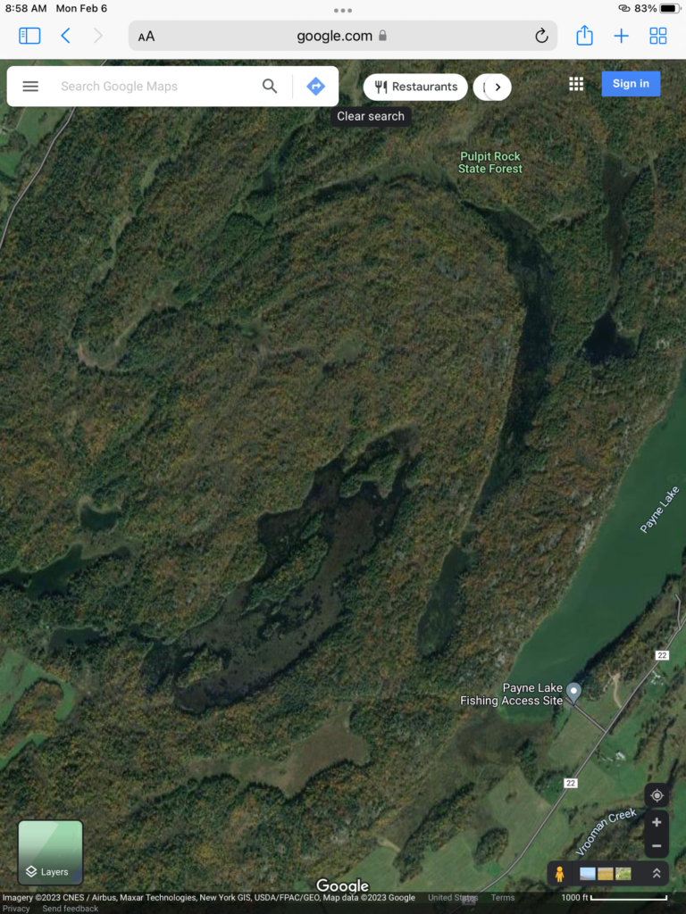
I spent a little time that Sunday morning studying the satellite map but never really put things into a proper size perspective. The trek looked simple and very easy from what I could see on the map. Many times I choose not to overthink or over analyze an area I wish to explore. It takes away from the experience I feel. In hindsight perhaps I should have taken greater pains to research my proposed adventure! Before it was over I began thinking of changing the spelling of the lake’s name! It might better be spelled “Pain’s” Lake! As in aches and pains! But that’s not important as the story is just beginning!
I decided in advance to upgrade my winter survival pack with extra layers of protection. I added an emergency survival shelter and emergency blanket. Extra food and water. A rope and larger knife. I also had an led headlamp,first aid kit, and a Lifestraw water filter cylinder. Electrical tape and other small amenities make up the balance of my pack. I also strapped on a set of micro spikes and stashed a heavy winter coat inside. The pack was rather heavy but there was comfort in my state of preparedness. I would be using my Tubbs backcountry snowshoes which work great for ice walking and climbing steep grades. I was ready!
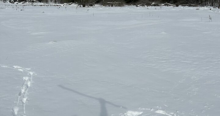
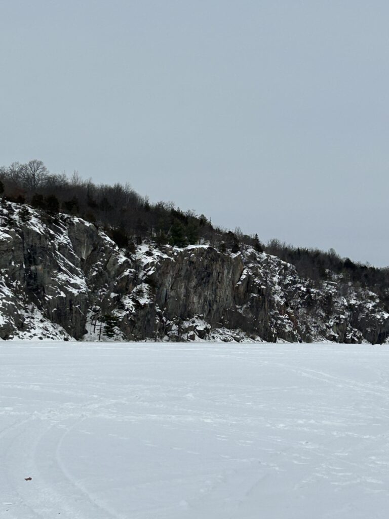
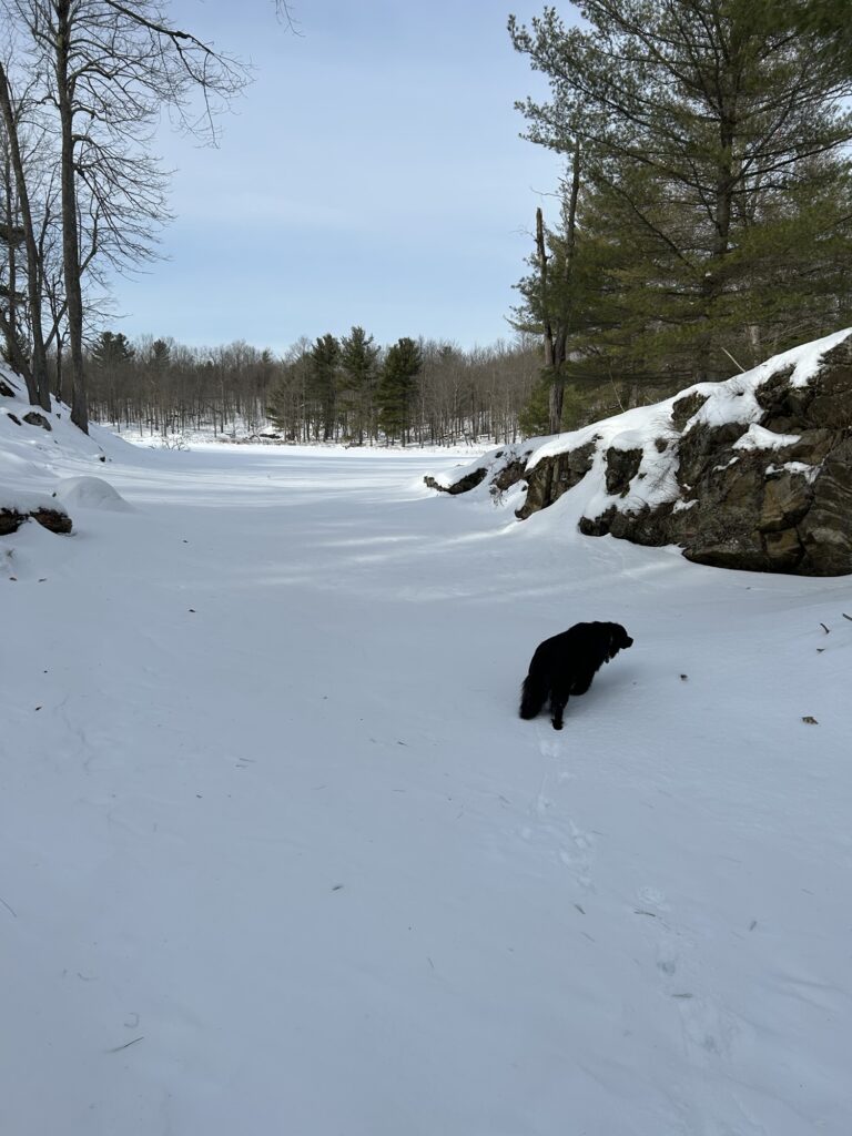
After arriving it didn’t take long to cross the lake as there were plenty of signs of ice fishing activity that established its safeness. There appeared to be at least 8” of ice after examining an open tip up hole. Plenty! I found my gap and tackled the ascent with the fresh energy of a new day. The dogs raced ahead of me sniffing around numerous deer tracks and browsing activity. I followed the deer trail as it offered the easiest way to the top. Never question that the animals will find the easiest path through rugged country. I rested on a high ledge and could see my truck across the lake. It looked rather small sitting there. It was at this moment that my mind first began to question my perception of the size of the location. Not to worry! The day was just beginning and I was a conqueror of new and exciting places! Go forth and explore with determination!
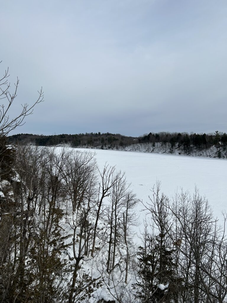
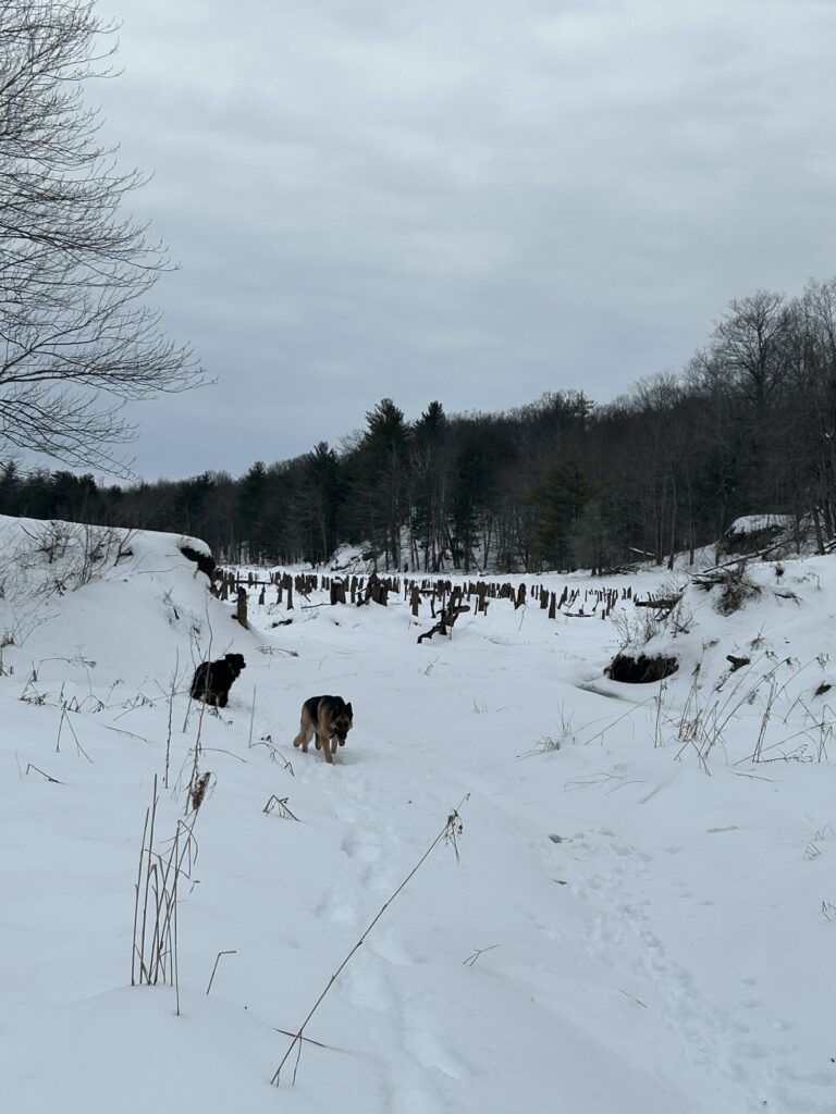
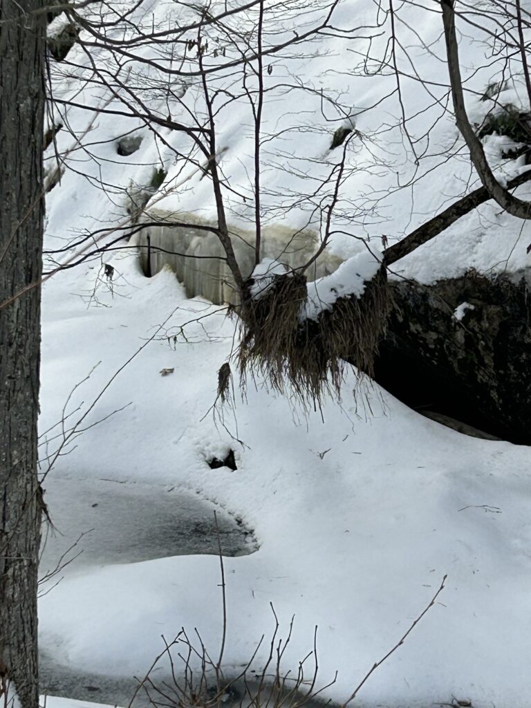
I headed in a Westerly direction and soon found the waterway that I had spotted on the satellite image. It wasn’t as large as I had expected width wise but extended well out of sight to the North. I reached the ice of an old beaver pond that had once been rather deep. Impressive but not an ancient lakebed by any stretch of imagination. I tried to pull up the satellite map but was unsuccessful without adequate service. My curiosity got the best of me and I decided to head North along a series of old beaver flows. I reached a breached dam of once large proportions. It had stood over 6 feet high at some point and had washed out in one giant event if I was reading the signs correctly. A former section of forest in the pond had been reduced to tall stumps. The ice was safe although there wasn’t much to snowshoe on. Things got better when I reached a small active beaver pond just below the breached dam. There was otter sign around the dam. Droppings and tracks everywhere. The wetland below me to the North widened significantly but held little water. But there was still plenty of ice to travel forward on. This too had once been a massive beaver pond but was still not looking like the ancient lakebed I was hoping to discover. I pressed on suddenly very acute of the size of area I was headed into.
It had gotten quite warm and I was truly enjoying my trek but was concerned about the distance I still needed to cross to reach the end of the wetland. The wetland curved to the West beyond me and I had to make a decision. Keep following or take the higher ground beside the marsh and reassess my options. I got myself convinced that if I kept going I would find my lakebed. After all shouldn’t it be connected? I pushed on with renewed vigor but certainly not as fast as earlier. I was breaking trail in trackless snow. It added to the allure of exploring fresh country but took a toll on my energy. Eventually I rounded the curve of the waterway. No lakebed! Just more old beaver ponds and a creek channel that continued to curve out of sight. I pressed on after looking back at the stretch of wetlands that I had already traveled. I continued to marvel at the size of this location and how vast it suddenly seemed.
I found some fresh beaver and otter activity on the surface of the waterway in a small beaver pond with a leaking dam that was dropping the water level. I found a fish head that the otter had left behind but couldn’t identify what species it had been. It had large scales almost like a carp. Strange! It had been decent sized though and no doubt made a tasty meal for the otters. I guessed that there were two otter because of the sets of tracks I found. Not uncommon as they usually travel in pairs. I once witnessed an entire family together with 6 individuals on top of the ice! Amazing! They dove in and would pop up through open spots like furry periscopes watching my dog and I! It was comical and a priceless moment in nature.
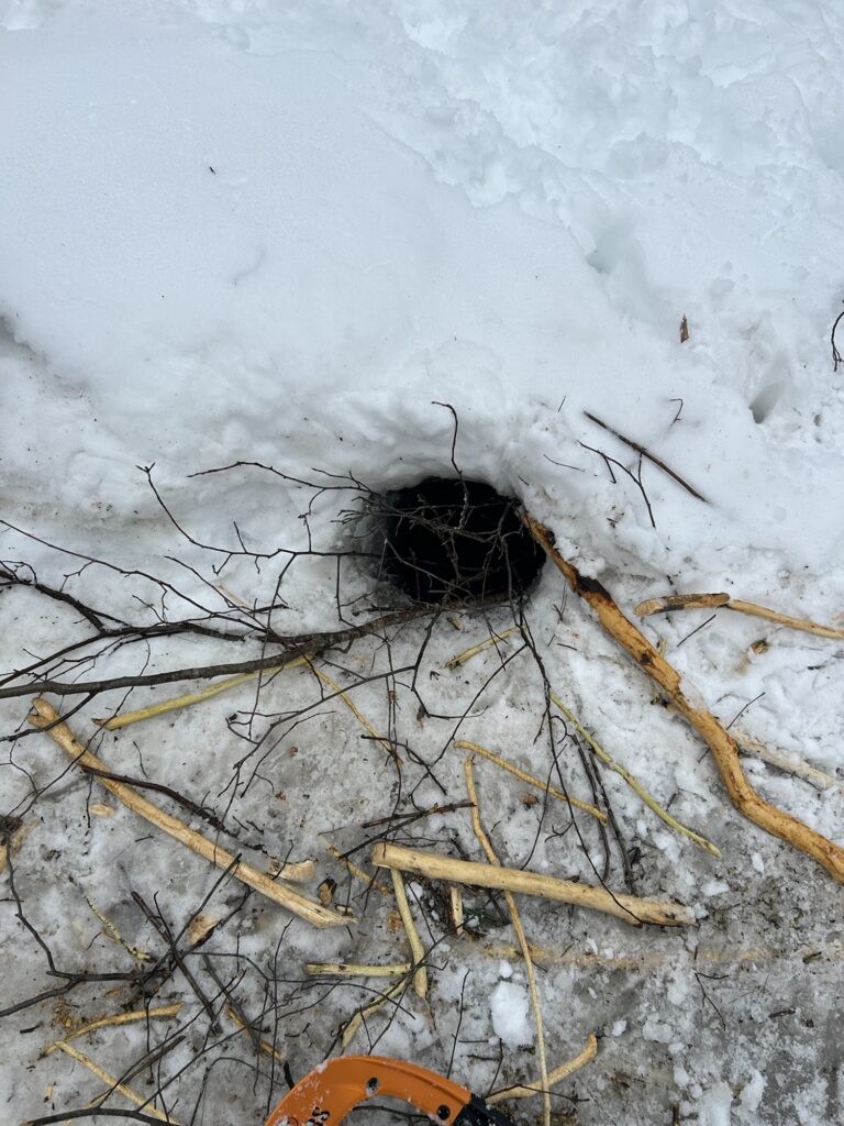
I stopped for a trek style meal of beef jerky, chocolate, energy bars, and water. The sun was getting well on into the afternoon and I was well aware of the time. But I decided to press forward in my desire to find the lakebed. I was a little confused by the lay of the land and the fact that I hadn’t intersected another waterway. With no map or phone service I was running out of time and options. And a small voice in the back of my mind began murmuring the Icewalker’s motto: the distance traveled in must be traveled out.” That’s not always the case on a loop trek but I was having difficulty figuring out how to accomplish a loop given my lack of knowledge of the area. Soon after though the creek system would make my decision easier. I reached an old beaver dam at a choke point with high ridges on both sides. The creek narrowed and dropped down into lower forested land with limited visibility. I chose to take the high ground and leave the creek system. No continue on would be foolish given how far I had traveled. Perhaps from the high ground I would see my ancient lakebed. If it even existed. I still felt that it did but with a sinking resolve I released that I would not likely find it on this trek. As I left for the high ground I was blessed with an answer to one of my speculative theories. Grass caught in a tree several feet above the narrow creek. A lot of water had passed through here and quickly! Only the breached dam could have caused such a thing to occur! I imagined what it must have looked like as a mass of water tried to force its way down the narrow gorge. Had other dams been breached shortly after the first large one causing a mega flood? It must have been something!
I took the high ground after a rigorous ascent but was disappointed when there was no view into the distance except more forest. I entered a section where there was evidence of old logging activities and realized that I had ventured beyond the state land while on the ice of the creek. I started in a direction that I believed would bring me back parallel to my original trek in. The snow was wet and much deeper in the forest. A series of hills added to my exertions and I was beginning to tire more then I wanted to believe. I had been keeping my bearings by the sun but it went under the clouds and became invisible. I knew my approximate location but began to be concerned that I could easily get turned around and wander in the wrong direction if I wasn’t careful. This was obviously a larger area then I had originally estimated. The little invisible voice spoke again: be careful Icewalker! You’ve entered an unknown forest and forgot your compass. Remember? It’s not in the pack. It got left on the bed! Best think this through! … Ok inner voice I hear you! I thought. But let’s not panic here! I can always backtrack.Not the fastest or easiest option.Or continue on in what I think is the right direction and search for even higher ground. Or follow my inner compass and turn left. The inner voice started in again: you’re pretty tired Icewalker! Are you sure about this? … ok inner voice be quiet! Did you forget that I am packed to stay out all night? (But the inner voice is a nagging and persistent devil!) Yes but think of the warm house and cozy recliner back there! Not to mention that yummy meatloaf in the crockpot!… in the end I turned left and soon ended up back on the creek on the wetlands. Not where I thought I would pop out though! I still had a long trek out! It would soon be time to wake up the inner zombie!My old companion!
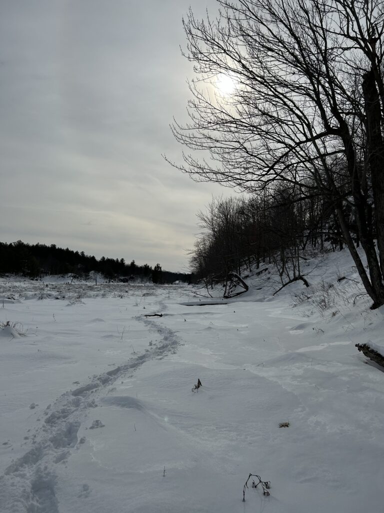
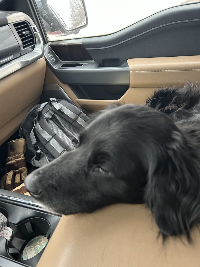
My fatigue really started to kick in as I plodded forward back up the wetlands. I was disappointed about failing to find the lakebed but soon decided that I should be happy about my discovery of the new location. It would never be new again from this point forward. The sun was sinking lower and the air was growing chilly. I had a long way to go! I summoned the inner zombie and let him control my feet. Step,lift,step.Repeat over and over.The inner zombie loves repetitive motion and mindless task. He has no point of quitting or even thinking about quitting. This mental state sounds weird and somewhat crazy but it works with timeless predictability. There are many levels to our consciousness and the inner zombie dwells in one of mine. The distance fell behind me and the end was getting closer! The inner zombie went back to his cranial recesses and I got a surge of energy from the coming darkness. Its that survival and challenge thing that drives me into these types of places. I left the wetland and could soon see the lake! I got my feet tangled and took a wild tumble down while descending the gap. Somewhat painful so it was then that I changed the spelling of the lake. And just like that the trek was over. In the truck and traveling back. Even the dogs were exhausted!
So that’s it! An epic day of exploration. I hope to return soon and search for the lakebed. It’s there! I just know it. As for the Pulpit Rock State Forest Preserve? At 1603 acres it’s much larger then I imagined! I know that now. Until the next one! ✍️