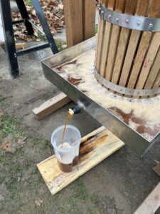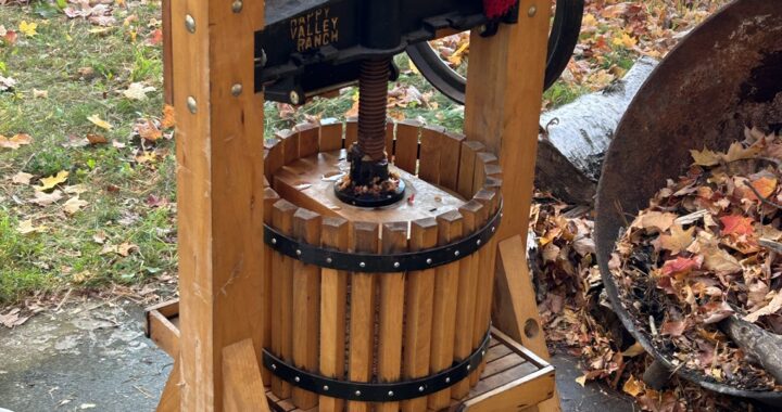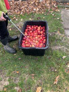
Apple cider making has passed for us as the first week of December nears its end. We have used all but a few select apples that have been saved for desserts. Mainly apple crisp that I sweeten with a touch of maple syrup! Yum! We enjoyed a fun and productive season thanks to Zane pushing me along! He’s good at keeping me moving and motivated with certain things. That’s a plus!

In the post titled Held In Trust I provided the background for my early years of making apple cider.After the first year making cider became an annual fall event provided we could locate an adequate supply of apples. Some years were better then others but we never again came close to matching the first year’s quantity. We would sometimes help people make some cider with their apples as part of a family outing. In 1994 something memorable occurred while working in the Mexico,New York area. I was in the heart of apple country and was driving to work there during the week. I knew an orchard owner nearby because I had rented a cabin behind his orchard while working on a different project in the spring. I approached the owner about buying “ground falls” under the trees. They were great apples and super cheap! I got them for about $3/bushel and would load up the bed of my Ford Ranger truck on Fridays. They made great apple cider and we pressed quite a few gallons! The cider press was always properly cleaned, covered , and stored away in a dry location. It had become a steadfast addition to our rural heritage lifestyle.
The next season we drove to Mexico to pick apples at a new orchard and were able to purchase some nice ground falls there. The orchard was called Sage Brook and we returned there for many years each autumn. We were asked to do demonstrations at a local church fall festival and introduced quite a few children to cider making. I even did a demonstration at the Hammond Central School one fall. By this time a young Zane was busy getting his cider making education and was enjoying the hobby as only a kid might do. The cider press had been moved around quite a few times at this point as home locations continued to change. I would always find a safe storage place for it though. The years were beginning to add up!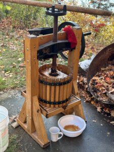
Zane was about to turn 15 in 2019 when we made cider at Hill House that fall. The apples came from Mexico as was our continued custom. We would manage to get to a few apples around the farm but the ground falls from downstate would make up the bulk our collection. We would make 4-6 gallons typically each fall. It was plenty and we would usually freeze part of it.Life happens fast sometimes and no cider was made in 2020 when I was still working in Beaver,Pennsylvania at the time. The cider press was moved to the storage container in March of 2021 and sat there through the fall of that year while I was working in Lake Placid. We rarely thought about it although Zane probably mentioned it on occasion. But life demanded certain sacrifices despite being retired and lucrative work opportunities were too good to pass up. 2022 would be much different however.
Early this fall we harvested a small crop of apples from an old Macintosh tree in the former yard of the now gone farm house. It had sometimes produced huge amounts of apples but the crop was light this year. We used the ones we got for apple crisps and shared a few with others. We found no other apples anywhere on the farm. Most of our wild apple trees had been lost to the tent caterpillars in 2016 and 2017. But picking those few apples got Zane fired up about making cider and that led to the press being dragged out of the storage container as told in Held In Trust.
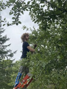
We located some apples in the Brier Hill area and talked to the owner about purchasing them in bulk. He was agreeable and we purchased several large bags of them for a small sum of money. They were nice apples from his small roadside orchard. Not huge since he sold those ones next to the highway for eating apples but they were perfect cider apples. We took them to Camp Edith and got set up for pressing cider. The apples were washed and then cut into smaller pieces before being ground into the press hopper. Zane and I worked quickly so it wasn’t too long before we had enough to press out our first batch. The yield was impressive and the cider was super sweet! We made about 7 gallons that first afternoon and still had enough apples left for another day of pressing. Zane returned to the camp later that week with a friend and they pressed out several more gallons. I helped him with the last batch using the outside light on the camp because it had gotten dark. It was a moment reminiscent of years past for me.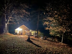
Zane and I stopped back at the apple seller’s house (Ray) the next day to return his bags as agreed upon. I brought him a quart of cider to try out and we got to talking. It turned out that he had a cider press of his own but no longer used it. Ray showed it to us and I immediately wanted it! I asked him if he would consider selling it. He said that he’d think about it and I left him my phone number. Back in the truck I asked Zane if we should buy it and discussed what we should pay for it. Did we really need it I asked? We already had one but this one was different and had some nice features that our older one didn’t. It had a separate grinder setup and used hydraulics to press the mash down. Zane said that we should try and acquire it!
Monday came and I got a call from Ray. He had more apples for us and was willing to sell the cider press if the price was right. I drove right over and the deal was quickly sealed with 10 bags of apples thrown in as a bonus. I gave him a fair price I felt without overpaying.
Zane and I picked the cider press up on Saturday. We made a deal with Ray to purchase apples in 2023 if he had them for us. He’s 82 years old after all and tending the orchard was a challenge for him at times.Sunday found us washing apples,grinding, and pressing out cider. We made over 8 gallons with our new machine and were thrilled with its performance. So here we are! December of 2022 with two cider presses held in trust! Plans to ramp up production in 2023. About to brew our first batch of hard cider as the law allows. I even have a name for it if we are successful! 